

Annonse
New Norwegian land could emerge from the Atlantic Ocean
Many active volcanoes can be found on the seabed within Norway's maritime borders. Some are now only a few metres below sea level.
Published
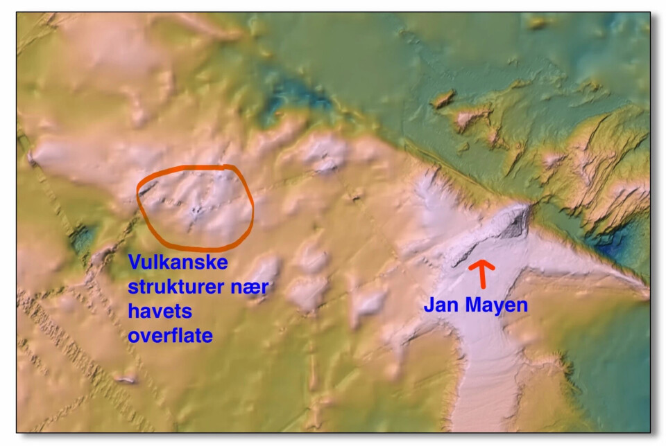
“In the areas west of Jan Mayen, we’re close to having new islands form,” says Håvard Stubseid.
“We’ve now identified volcanoes only a few dozen metres below the ocean’s surface,” he says.
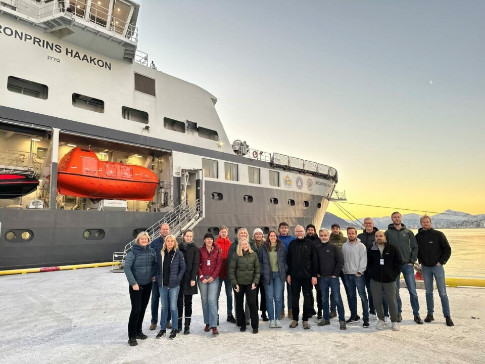
Stubseid has just returned from a research stint on the RV Kronprins Haakon. The researchers are studying a dramatic mountain landscape in the deep sea between Jan Mayen and Svalbard.
They have made several exciting discoveries.
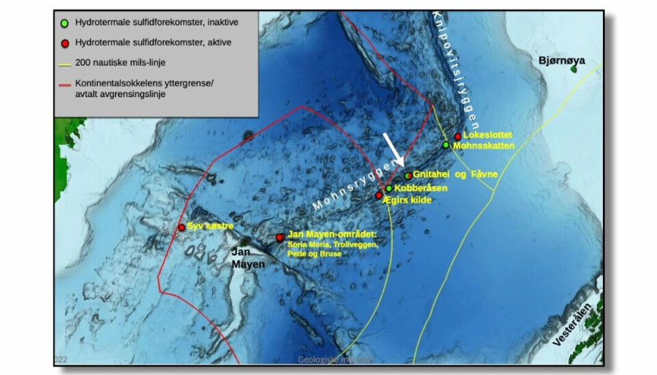
Along Mohnsryggen and Knipovichryggen – Norway's part of the volcanic Mid-Atlantic Ridge north of Jan Mayen – the researchers on this and another German-Norwegian expedition last summer discovered new black smokers at a depth of around 3 000 metres. Black smokers are chimney-like structures commonly found near volcanically active places
Annonse
Perhaps this is where life on Earth began?
Down to 3 000 metres below sea level
Stubseid is a deep-sea researcher at the Centre for Deep Sea Research in the Department of Earth Science at the University of Bergen. Volcanology is one of his fields of expertise.
The voyage he took part in on board the RV Kronprins Haakon was the first of three planned research expeditions to these areas through 2024.
“The vast majority of volcanoes in Norwegian areas lie at huge ocean depths, often down to 3 000 metres,” says Stubseid.
“But the areas around Jan Mayen are special.”
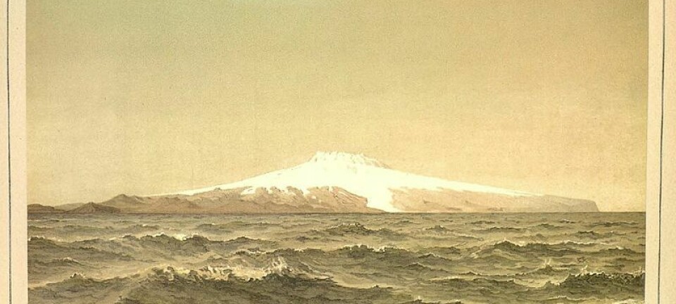
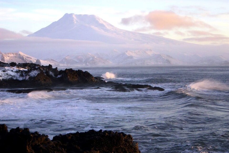
Beerenberg is a 2 277 metre high volcano on Jan Mayen. Scientists thought it was dead – right up until 1970. Then the 20 kilometre wide volcano suddenly had a major eruption.
Yearly ‘Norwegian’ volcanic eruptions
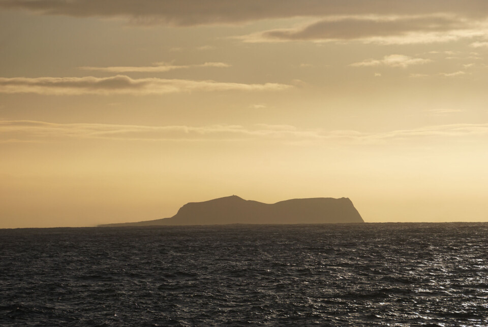
West of Jan Mayen and Beerenberg, the ocean is quite shallow. And they are volcanic.
Stubseid admits that it would be really awesome if an island arose out of the sea here.
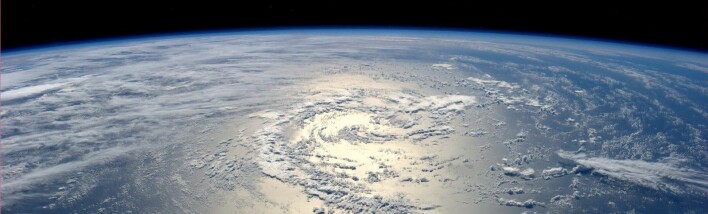
Beneath the ocean surface in the North Atlantic there is a lot of volcanic activity. Until a few years ago, we knew very little about it.
Now scientists are steadily learning more.
They know that we have, on average, one underwater volcanic eruption in Norwegian deep sea areas every single year.
Stubseid alerts us that the next time such an eruption occurs, it’s quite possible that we’ll see a new Norwegian island in the Atlantic Ocean being formed.
Annonse
Volcanic mountains approach the surface of the sea in the areas west of Jan Mayen.
“There are structures here that are only a few dozen metres below sea level now,” he says.
The Mid-Atlantic Ridge
The Mid-Atlantic Ridge is the name of the undersea mountain range that runs along the middle of the entire Atlantic Ocean – from the Southern Ocean in the far south of the globe to the Arctic Ocean northward beyond Svalbard.
The ridge follows a crack where the seabed in the Atlantic Ocean is splitting apart.
The crack widens by about 2 centimetres every year, and around Jan Mayen, perhaps about 1.5 centimetres each year.
It's not much. But enough so that lava keeps gushing up from the Earth's mantle.
This activity takes place almost exclusively at deep ocean depths. The only place above sea level where we can see what is going on is in Iceland.
Perhaps we will eventually also see volcanic activity form a new island within the Norwegian economic zone west of Jan Mayen.
Unmanned submarine takes to ocean depths
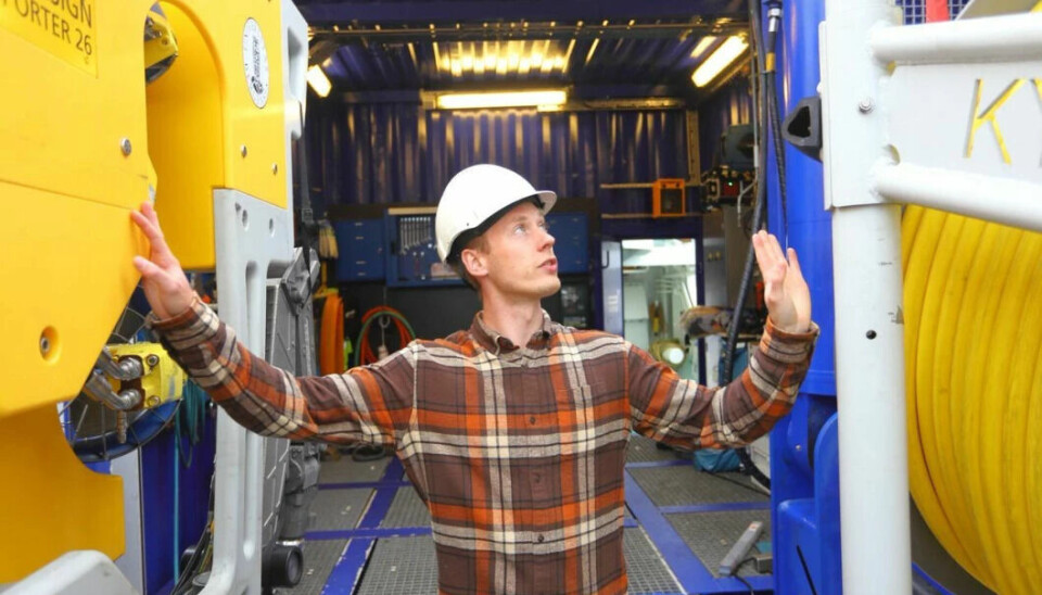
RV Kronprins Haakon was launched five years ago and is one of the world's most advanced research vessels.
“Our voyage this autumn to the mid-ocean ridge between Jan Mayen and Svalbard was very successful,” Stubseid says.
The vessel is a PC3 icebreaker class ship with 15 laboratories on board. Most important for Stubseid and his colleagues on this trip, however, was the University of Bergen's remote-controlled submarine, which can descend to a depth of 6 000 metres.
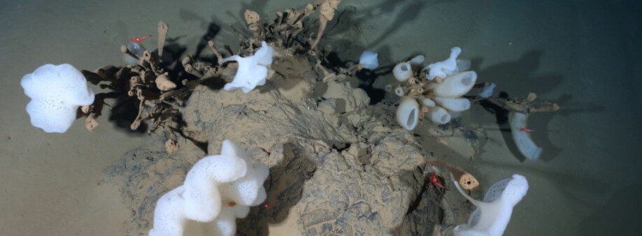
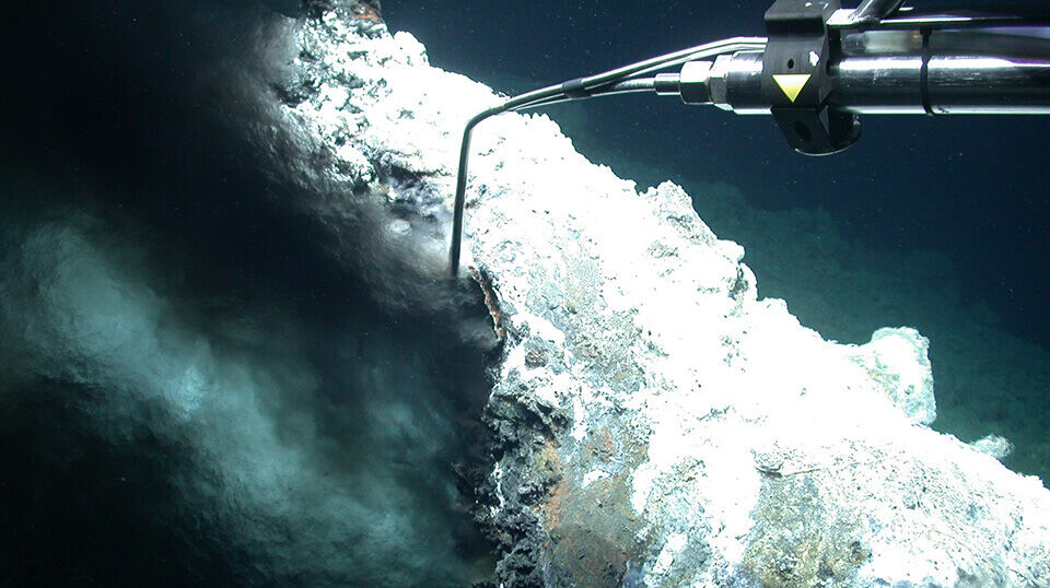
The researchers on this expedition were particularly interested in a geological phenomenon called ‘black smokers’, which are hydrothermal vent chimneys.
Only a couple of decades ago did scientists become aware that black smokers can be found along mid-ocean ridges at the bottom of the world's oceans.
The chimneys spew water that is several hundred degrees Celsius and also precipitate large quantities of valuable metal sulphides that settle on the surrounding seabed.
Much of the earlier attention on black smokers has involved unique biological communities that researchers have observed existing around them.
One theory is that the biological conditions here could be the starting point for life on earth.
Now the interest has extended to the possibility of finding rich deposits of rare minerals around black smokers, such as are needed to make high-tech equipment.
Black smokers in Norwegian areas
“We’ve now found several black smokers in Norwegian areas,” Stubseid says.
“A number of them are in areas around Jan Mayen and continuing northward towards Svalbard. Here they’re located roughly 100 kilometres apart.”
Stubseid says that if it becomes relevant to exploit the deposits of valuable minerals around black smokers commercially, then deposits that are no longer active must be targeted. The active hot smokers are, as mentioned, host to completely unique life forms.
Another challenge with the areas around black smokers is that the minerals here will eventually be covered with lava and sediments that settle on the seabed.
“The further away you move from the rift in the seabed, the more difficult it becomes to exploit these resources.”
“At the same time, it’s important to protect black smokers. They’re completely unique geological and biological phenomena that are an important part of Norwegian nature.”
Mountains in the deep ocean
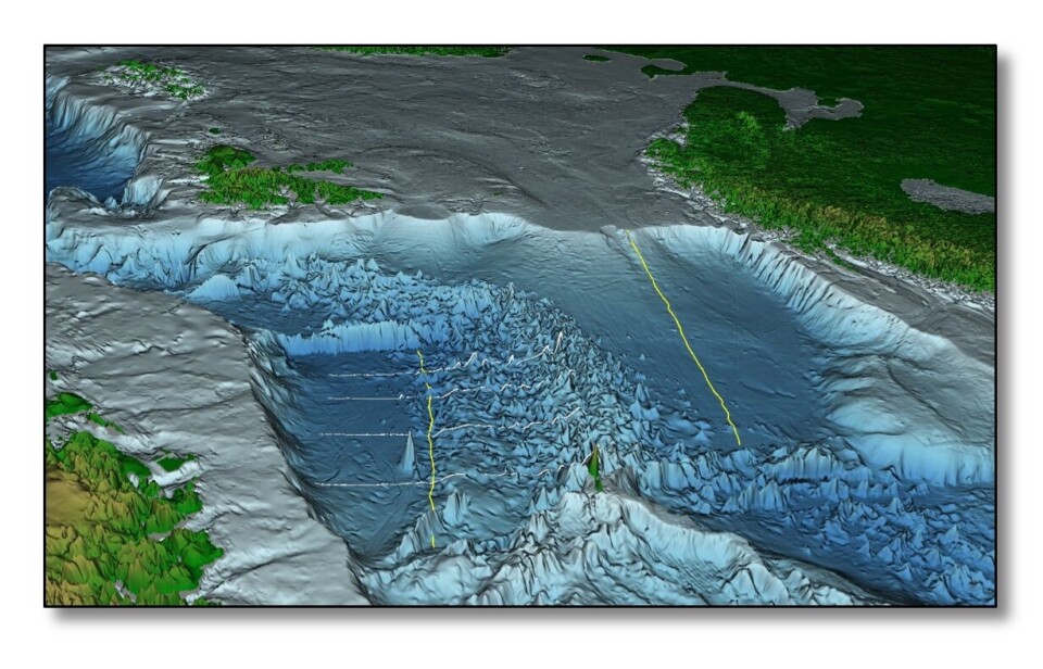
The landscape on the seabed between Jan Mayen and Svalbard is extremely hilly.
“A lot of people think that the seabed in the deep ocean is flat. But the border area between the Norwegian Sea and the Greenland Sea is certainly not flat,” says Stubseid.
“Here we see height differences of 3 000 metres.”
“Some volcanoes are over a thousand metres high and up to 30 kilometres long.”
GoNorth Expeditions
The GoNorth expeditions, which will take place through 2024, are Norway's biggest investment to date in exploring the Arctic Ocean.
The expeditions have been in the planning phase for 12 years.
A total of 13 universities and research institutes are participating.
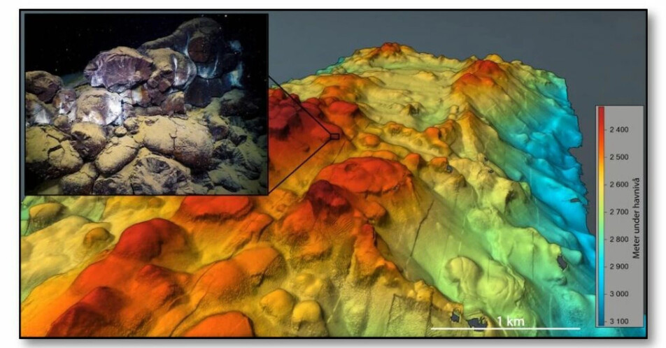
THE MAREANO programme is another research project in which the Norwegian Mapping Authority, the Geological Survey of Norway and the Norwegian Institute of Marine Research are collaborating to map Norway's ocean regions. Researchers can now map the seabed up to a depth of 3 000 metres and several kilometres wide with the help of advanced echo sounders.
“This is how we can see everything that sticks up more than 20 metres from the seabed,” says Stubseid.
“We can also create maps with a resolution down to 50 centimetres.”
“We do that by sending a torpedo-like autonomous underwater vehicle along the seabed. We’re able to get incredible pictures from the ocean depths,” the deep-sea researcher says excitedly.
This map by the Norwegian Mapping Authority shows Norwegian ocean areas in the North Atlantic.
References:
Harald Brekke, Norwegian Petroleum Directorate: Geologiske modeller, betydning for ressursevaluering. (Geological models, significance for resource evaluation), 2 June 2022.
MARUM: New hydrothermal field discovered by MARUM expedition, 19 August 2022.
Geological Report, podcast from UiB.
———
Read the Norwegian version of this article at forskning.no
------


