Detecting oil spills with satellite
How to discern between a slick of oil pollution and harmless layer of microorganisms from an algal bloom? Bombard it with a radar from a satellite!
Denne artikkelen er over ti år gammel og kan inneholde utdatert informasjon.
If you want to identify oil spills immediately you need to monitor enormous areas 24-7. The best view is from up in space.
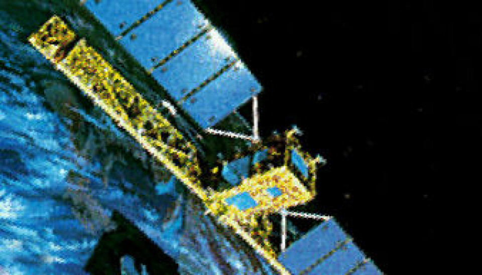
Earth observation satellites such as TerraSAR-X og Radarsat-2 fire pulses of radar at the sea. These pulses are reflected back up to the satellite as echoes.
Oil on a rough sea
The amount of echo that returns tells a lot about the ocean surface. Small waves deflect radar pulses in all directions, including back at the satellite. With radar vision, this makes the sea look bright.
Oil spills cushion small waves. There’s even an expression for calming a situation down: “Pouring oil on troubled waters”.
The diffusion of the echo is narrower when the sea is calmer, making the surface of the sea act more like a mirror. Most of the radar waves bounce one way, away from the satellite. With radar vision the echo from a calm sea appears darker.
False alarm
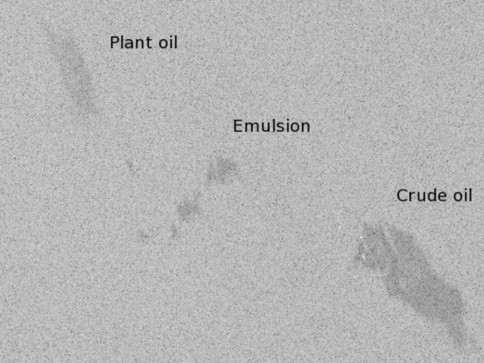
“This picture from Radarsat-2 was taken from an orbit 800 kilometres up. It shows three dark spots but only the lower one is a genuine crude oil slick,” says Stine Skrunes.
She’s working on her doctorate at the University of Tromsø’s Department of Physics and Technology. Her thesis is in methods of distinguishing among oil slicks and more innocent dark patches on the radar image.
“At the picture we see one slick of plant oil and another of an emulsion, which is a mixture of water and crude oil,” she explains.
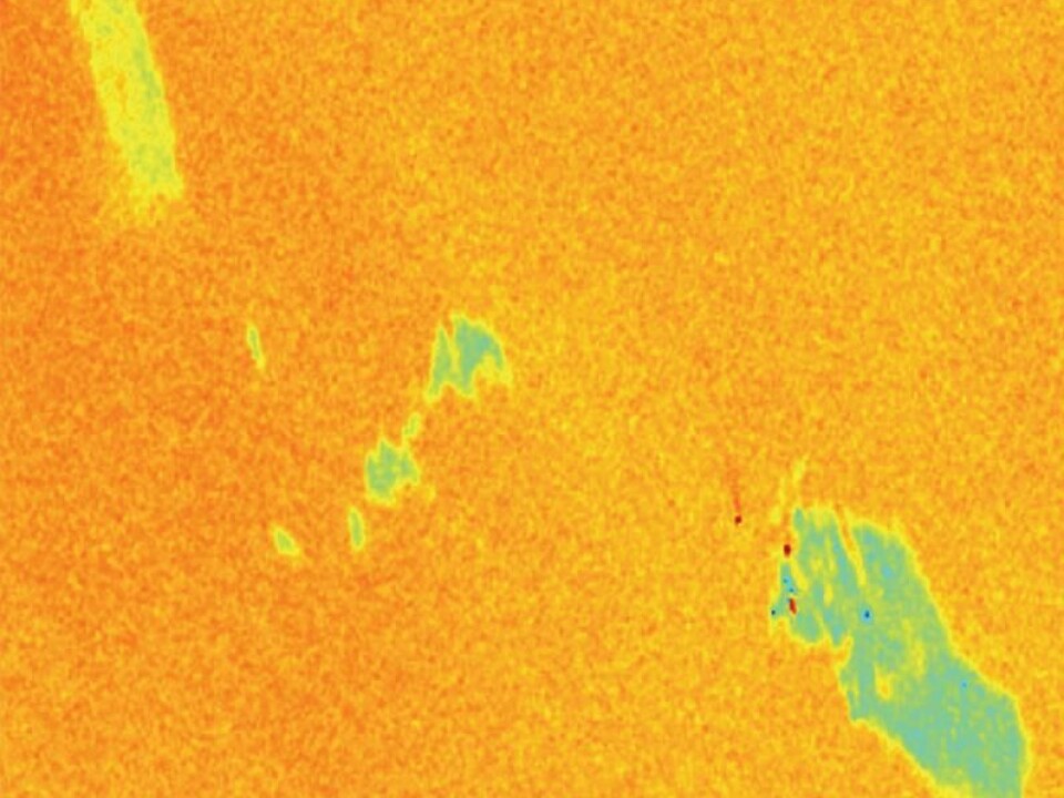
Algae often make slicks like that on the picture, which can be mistaken for real oil spills. Local areas where waves are smaller than in the surrounding sea can also cause a false alarm.
Polarised echo
Skrunes works on developing a new method for distinguishing between calms caused by algal blooms and calms designating oil pollution. This requires a study of more than the strength of the radar echo. She also has to look at which direction the radar beams in the echo turn, due to polarisation.
“Radar beams are electromagnetic like light − they’re just on different wavelengths. The polarisation can change when they are reflected,” she says.
One might recognise this phenomenon from skiing in the mountains at Easter. The glare is partly blocked by Polaroid sun glasses.
What happens is that the sea and the snow reflect back light waves which oscillate horizontally. Polarised lenses block the horizontal light waves in the reflection, just letting the vertical ones through.
Different polarisations
Radar reflections can also change the direction of their oscillations, or polarise. The echo of common oil spills and films created by algal blooms will yield different polarisations.
“I compare the polarisation of the radar pulse that is beamed down and the echo that returns,” explains Skrunes. She shows us a picture in which light of only one polarized direction slips through.
“In this picture we clearly see that plant oil sends a stronger reflection, whereas crude oil looks darker.”
Controlled spills
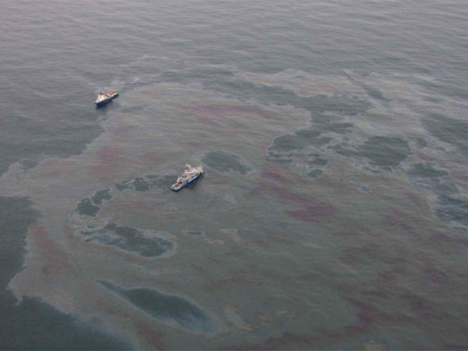
The three patches of different oil types in the picture were released from a boat intentionally.

“The Norwegian Clean Seas Association for Operating Companies (NOFO) runs an annual oil spill drill in the North Sea, where equipment and routines are tested. I participated in this exercise, when large but controlled amounts of each type of oil were released,” says the researcher.
Aerial photos can help in the interpretation of satellite images. One thing is they enable us to see areas of varying thickness.
Different thicknesses
“One of the factors making it feasible to distinguish between mineral oils and biological films is the large disparity in their thickness.”
Films made by algae and other biological sources are really thin, only about 2.5 nanometres. Petroleum slicks can be several millimetres thick, sometimes close to a centimetre.
“In June I’ll get a chance to study oil slicks from sea level, and I’ll be measuring their thickness and take photos of them.”
The more detailed the surface data, the better the interpretations of the satellite imagery. The researchers will be able to relate the images to the types of films and to characteristics such as thickness distribution.
“The ability to extract such information from satellite pictures will be really beneficial, especially in clean-ups after oil spills,” concludes Skrunes.
--------------------------------------------------
Read this article in Norwegian at forskning.no
Translated by: Glenn Ostling


