Forests get only minor boost from climate change
Why are we getting more forest and higher timberlines? The main explanation is a decline in animal browsing and small-time forestry. A warmer climate has had little impact on forests over the last 50 years, say Norwegian forestry experts.
Denne artikkelen er over ti år gammel og kan inneholde utdatert informasjon.
“… would if we adorned the mountain?” said the juniper to the pine, across the way. “If anyone it would certainly have to be us,” replied the pine. It stroked its beard and looked toward the birch: “What do you think?”
So opened Bjørnstjerne Bjørnson’s story about the boy Arne Kampen, published in 1859.
Over 150 years later Anders Bryn of the Norwegian Forestry and Landscape Institute at Ås has come up with another explanation to why spruce, pine and birch are now conquering new territory where “the north wind had swept in through the chasm and screamed into the crevices; where sheer rock jutted massively outward and froze.”
And the answer isn’t blowing in the warmer winds. Climate changes in the past 50 years amount to just a few percent of the fresh blanket of forest that is spreading across Bjørnson’s frigid and naked mountains, according to Bryn.
Norway 1850
At the root of what’s going on we have to return to the Norwegian landscape where Bjørnson placed his protagonist Arne Kampen.
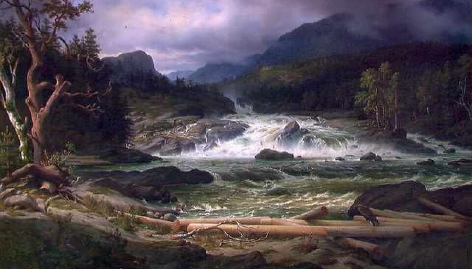
In the mid-1800s far more goats, horses and cattle browsed in mountain farmlands than today. They kept the forest at bay. Scythes cut steep fields and birch leaves were picked to use as winter fodder.
Axe blades chopped into juicy branches and stems. Large spruces were felled, their logs used to construct cog-jointed buildings and their bark outer layers were scraped off to make rail fences for a rapidly expanding population.
Production of tar, charcoal for pig iron and the boiling of milk for cheese demanded more wood than the forest could provide.
Deserted pastures and browsing areas
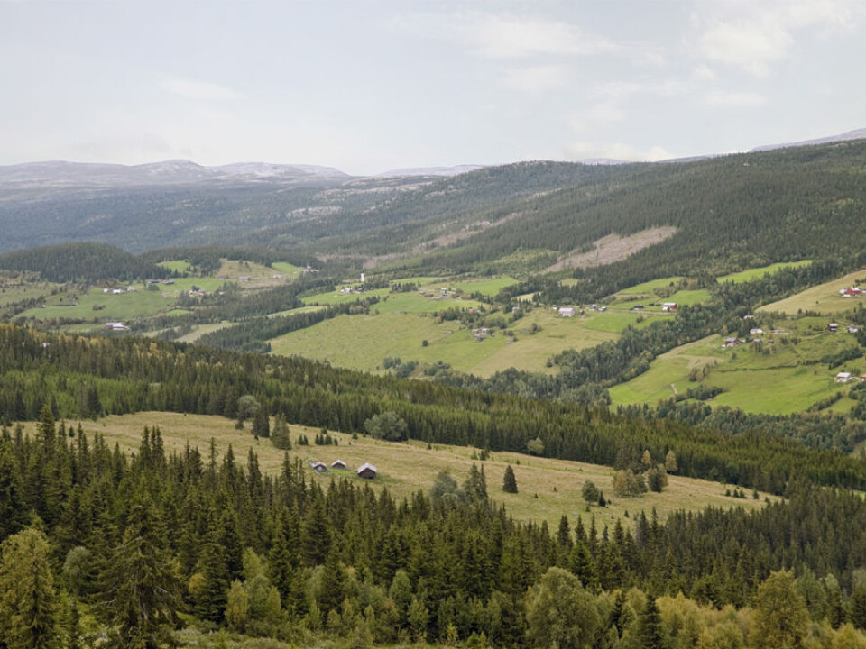
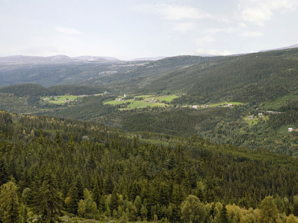
In Venabygd there were 50 summer mountain farms and thousands of goats around the time when Bjørnson wrote about Arne. This rural community is situated in a side valley of Gudbrandsdalen, just north of Ringebu.
Today just one such farm is still in operation. Although the sheep population has increased, their outdoor browsing season is much shorter than in the old days.

Now the sheep generally browse further into the mountains. Thus they aren’t around to keep the forest away from the summer farm areas.
The forest in Venabygd was thoroughly mapped by Anders Bryn. The question he sought an answer to was how much of the overgrowth in the area was determined by climate change and how much was caused by a decrease in cottage forestry and a reduction in livestock chewing foliage in the outfields?
1959 and 2001
Bryn had no data from Bjørnson’s day. But he could use maps of the vegetation from 1959 and 2001. These provided solid information combined with newer aerial photos and studies in the field.
There’s also a weather station at Venabygd. It gave Bryn climate data, but not sufficiently far back in time. But more data was available from an older weather station at Fokstua, where the clmate is almost identical.
Bryn could also see how climate changes had affected the growth of spruce. The more the spruce grew in a given year, the warmer its mean temperature.
Wilderness and climate maps
He made two maps from this information. One was a wilderness map which showed how the forest would spread if all the people and livestock left Venabygd and let nature run its course.
The other map used data from the IPPC’s climate panel to model how climate changes alone would alter the landscape. Which map matched the present terrain best?
Trees are winning back the forest
Changes from 1959 to 2001 turned out to fit the wilderness map better than the climate map. The conclusion was clear: more than nine-tenths of the overgrowth of forest was determined by a change in use of outlying fields.
The timberline has risen higher, not primarily because of a warmer climate, but because busy muzzles no longer tear out and chew saplings from the mountain farm meadows.
And most of the new vegetation has occurred well below the climate-based tree or timberline, according to Bryn’s mapping.
It’s elementary: when the farmer put away his axe, the trees took their forest back.
Three models
The extensive mapping of Venabygd was published in 2008. In February this year Bryn and Lars Østbye Hemsing teamed up to publish a new study. It confirmed that new forest is caused by a changed use of outlying land, this time in the region around Beitostølen.
Here the researchers used several methods for producing a wilderness map of the future. One method used an expert-based manual modelling procedure, a second used a computer data method from 2008 and the third used a more advanced statistical method which is recommended by leading scientists in ecological modelling.
All three methods gave approximately the same result: the forest is advancing toward the wilderness map. The landscape is becoming overgrown.
Nevertheless, the maps indicate that climate changes have slightly accelerated the growth of forest. But it would take much more before climate changes are a key factor for forest advancement. The conclusion from 2008 has been corroborated.
Faster change at lower altitudes
“This is exciting reading and solid research,” confirms Research Fellow Jonas Karstensen at CICERO, the Center for International Climate and Environmental Research in Oslo.
“One of the major uncertainties is how much climate changes will impact timberlines,” he says.
When it gets warmer, trees can grow further up the mountains. But growth is slower up at higher altitudes.
“This means the impact of climate changes could take a long time to show up in the mountains,” says Karstensen.
“In the lowlands the soil is richer and the temperatures even higher, so in general the results will be seen sooner there.
“This will for instance give us more of a Continental forest, with more deciduous trees. In times to come we’ll witness the combined effect of changed agricultural practice and climate changes.”
More forest in the future
Anders Bryn has also published a new study in April 2012 together with colleagues in Norway and Peru. It shows that if Norwegians died off or fled Norway and nature could take the entire country back, the forest would close in on about one-sixth of today’s landscape.
This isn’t just a totally hypothetical situation. Nature regained much of Venabygd and the rest of the country when plagues swept across the country and decimated the population, starting in 1349.
A common Norwegian surname and place name is Ødegård, which means “deserted farm”. After the pandemic waves struck, many farmlands lay waste and were overgrown by forests for decades before being reclaimed by later generations of survivors.
Culture, not nature
Bryn and Hemsing have submitted yet another article about regrowth of forests for publication. It confirms the earlier results but also shows that the regrowth in Norway will be more prolific in certain areas.
New studies from Vik in Sogn og Fjordane County, Beitostølen in Oppland County and Hadsel in Vesterålen, Nordland County, show that over half of the landscapes in Norway would look a lot different without us and our livestock.
The Norwegian cultivated landscapes we display in our tourist brochures, and love to drive, bike or hike through, are not virgin forests and unsullied nature. These are mainly cultural landscapes and it’s up to us to retain them as they are.
-----------------------------
Read the full story in Norwegian at forskning.no
Translated by: Glenn Ostling
Scientific links
- Anders Bryn: Recent forest limit changes in south-east Norway: Effects of climate change or regrowth after abandoned utilisation? Norwegian Journal of Geography Vol. 62, 251-270. Oslo - 2008. DOI 10.1080/00291950802517551
- Lars Østbye Hemsing & Anders Bryn (2012): Three methods for modelling potential natural vegetation (PNV) compared: A methodological case study from south-central Norway, Norsk Geografisk Tidsskrift - Norwegian Journal of Geography, 66:1, 11-29 (abstract)
- Anders Bryn, Pablo Dourojeanni, Lars Østbye Hemsing & Sejal O’Donnell (2012): A high-resolution GIS null model of potential forest expansion following land use changes in Norway, Scandinavian Journal of Forest Research, DOI:10.1080/02827581.2012.689005


