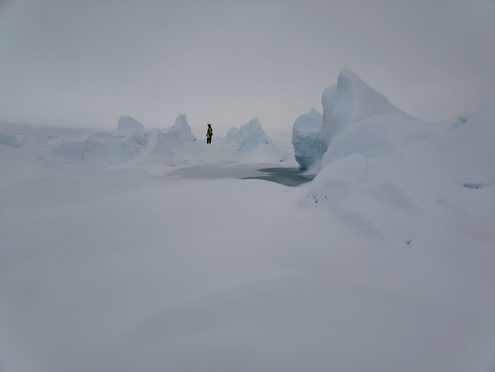
Ephemeral landscapes
Have you ever watched the colors of the sunset over the sea – then suddenly the beautiful moment is gone, and darkness surrounds you. Arctic sea ice is like that - a temporary and beautiful landscape constantly presenting moments that are suddenly gone, if you dare to blink.
Sea ice is a lot of things. It gets made when the upper ocean becomes cooled enough (around -1.8 C for regular seawater) to freeze. In the right conditions, eventually vast regions of ocean become covered by highly dynamic layer of ice. This thin layer affects how heat, light, momentum and gases are exchanged between the vast ocean and vast atmosphere – impacting the local environment of things which live here, and the earth system as a dynamic whole.
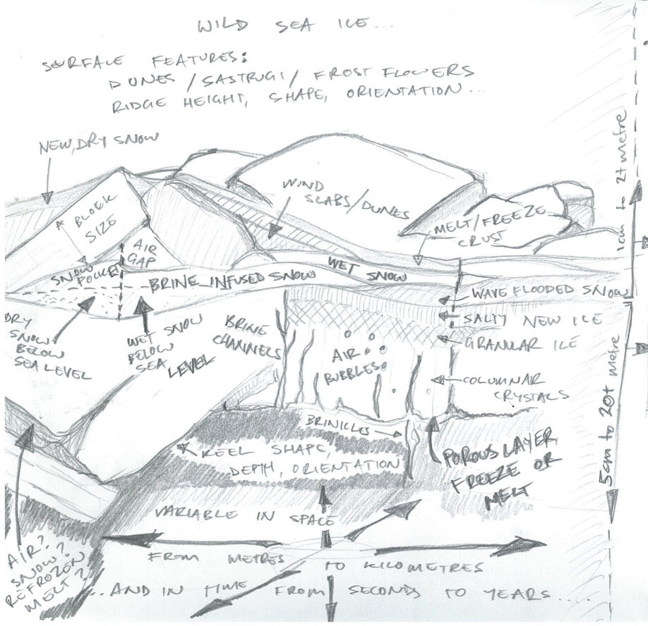
...but it doesn’t stop there. Sea ice is itself a complex composite assembled from different types of ice at different stages of growth and decay; air gaps, water, slushy ice filling in voids; snow in complex layers of its own; and finally the living component – everything which makes sea ice its home, and the biological material they produce and leave behind. The diagram below shows only a simplified view
Understanding how it looks – its shapes, how big or small things are, how they are assembled together – is like the microbiology of sea ice. To use ourselves as a metaphor, we can observe ‘body’ or ‘organ’ or even sometimes ‘cell’ size components of the sea ice system using remote sensing, usually satellites equipped with cameras (using light or radar) and altimeters (lasers and radars). In order to interpret those as well as possible, we need to go deeper – into the ice. What proteins are expressed? What’s going on between synapses? How do the structural parts look and what are they made of? How do these small components affect the larger scale system?
Here in the Arctic ocean aboard RV Kronprins Haakon we bring a range of approaches to this task. We are coordinating high resolution radar imagery from space, instrumented helicopter flights, smaller scale drone missions, person-towed instruments to measure fine scale sea ice properties, all the way to ice corers, drills and measuring tapes.

It is a lot – and difficult to find the mix of weather, light and wildlife encounters (polar bears, but then, we work in their house) to get a complete set of measurements, so we triage our approach and work from the basics up. The bare minimum we need to investigate the physical properties of sea ice which is also intensively sampled for things which live in it, is a few ice cores at the same place. From those we can discover whether the ice grew in calm or turbulent conditions by what kinds of ice crystals are present, whether it is still growing, and describe its physical properties generally.
This, however, is a single point in space and time. Broadening our scope, we use electromagnetic induction surveying tools, a simple semi-automated snow probe and a lot of walking or skiing to collect hundreds or thousands more observations about the snow and ice thickness on the ice floe we are sampling, From this we can say something about whether the point sample we took can be generalised across an ice floe. We also aim to cover enough area to be, seen from space’ using near coincident radar imagers.
...and we still have gaps. We attempt to fill these with small drones, mapping the site with hundreds of overlapping images and then using computer vision and photogrammetry techniques to reconstruct the immediate area of our point sample.
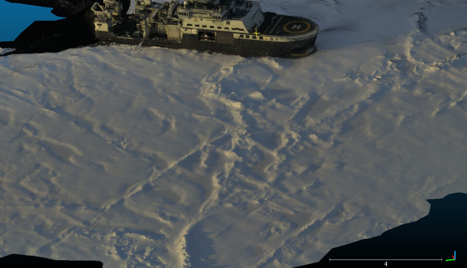
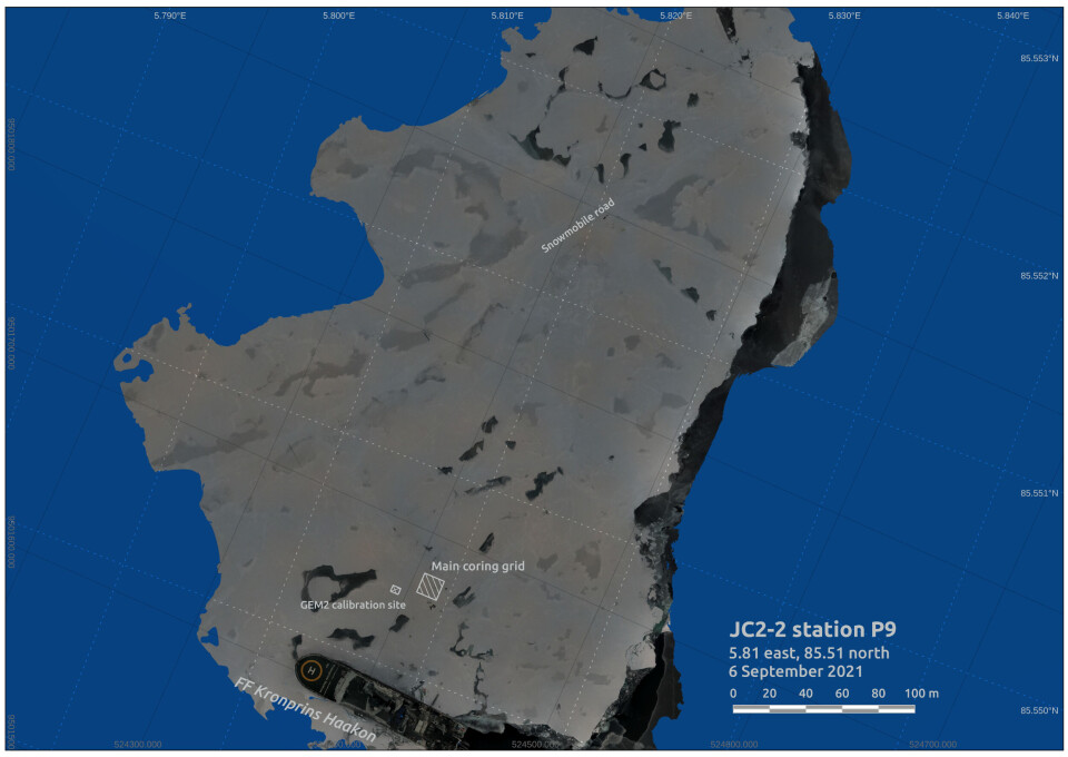
Using modern geospatial tools we can assemble these data in ways that were extremely difficult even a decade ago. We will overlay very high resolution drone maps over satellite pictures, align walking tracks with towed instruments with both of those, and then add information about the state of ice at point sampling sites. In this way we can build a multi-scale picture of how sea ice looks, what makes it up, at a range of scales relevant to people taking samples on the ground as well as satellite imagery analysts working remotely. In turn this level of detail can give a framework for asking questions like ‘why does a thing live here in the sea ice but not there, just a few metres away?’
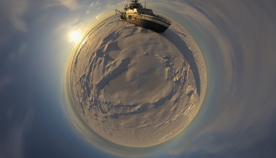
Sea ice is an ephemeral landscape, incredibly diverse and variable at scales from centimetres to hundreds of kilometres. When we take a snapshot of what is out here, when we walk around towing our tools of the trade to measure its properties, we are often the only humans who will ever see the places we have explored – a privilege which is granted to few on this planet of ours.
How we approach this place, and communicate about our experiences, often has more impact than the numbers and equations and dry facts we extract. It changes us forever, and that is multiplied when we relay our story to others. So it is also our task to bring back with us the sense of wonder we feel when we encounter, experience, immerse ourselves in these ephemeral landscapes. How does the arctic sea ice affect us, and our internal world, is just as valid a question as ’how thick is the ice?’.
Follow us!


