Annonse
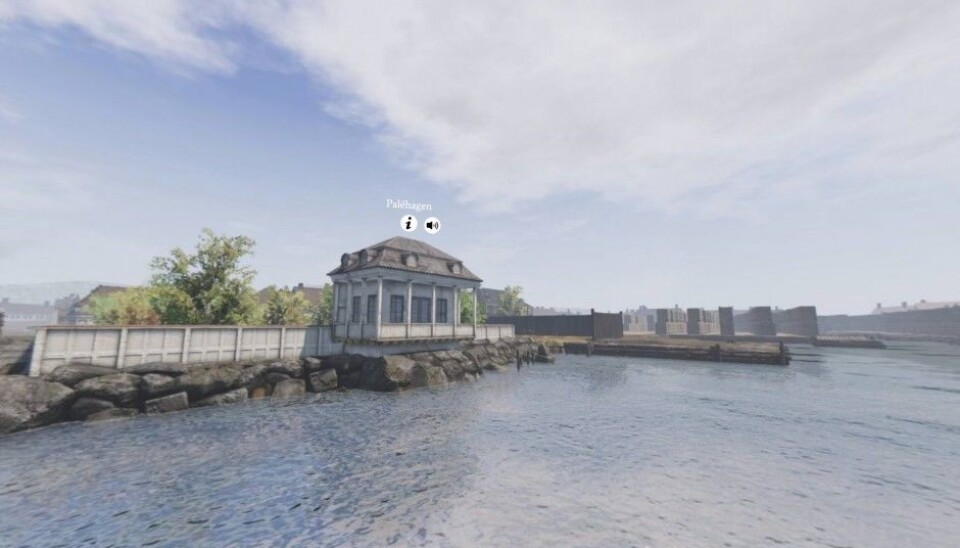
A virtual time machine for the Port of Oslo of the 1700s
If you have a 3D printer, this website even lets you print out small buildings from 18th century Oslo.
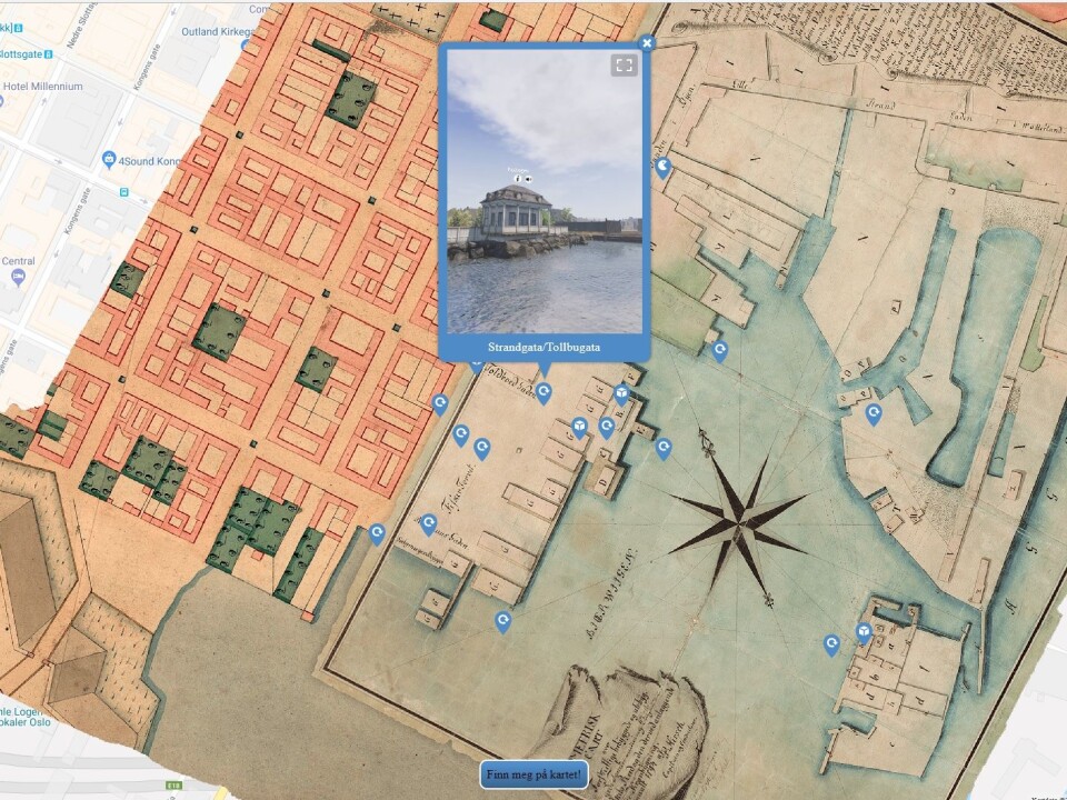
Imagine if you could somehow drop a historic map on top of Google maps to see how a place has changed over the centuries.
Historian Ragnhild Hutchison has gone one step further with this thought experiment: she has been busily working to build a website and app to visualize how the Port of Oslo Harbour looked 220 years ago.
"The idea is that you can physically stand somewhere at the Port of Oslo, pick up your phone, open our map and travel back to 1798," she says.
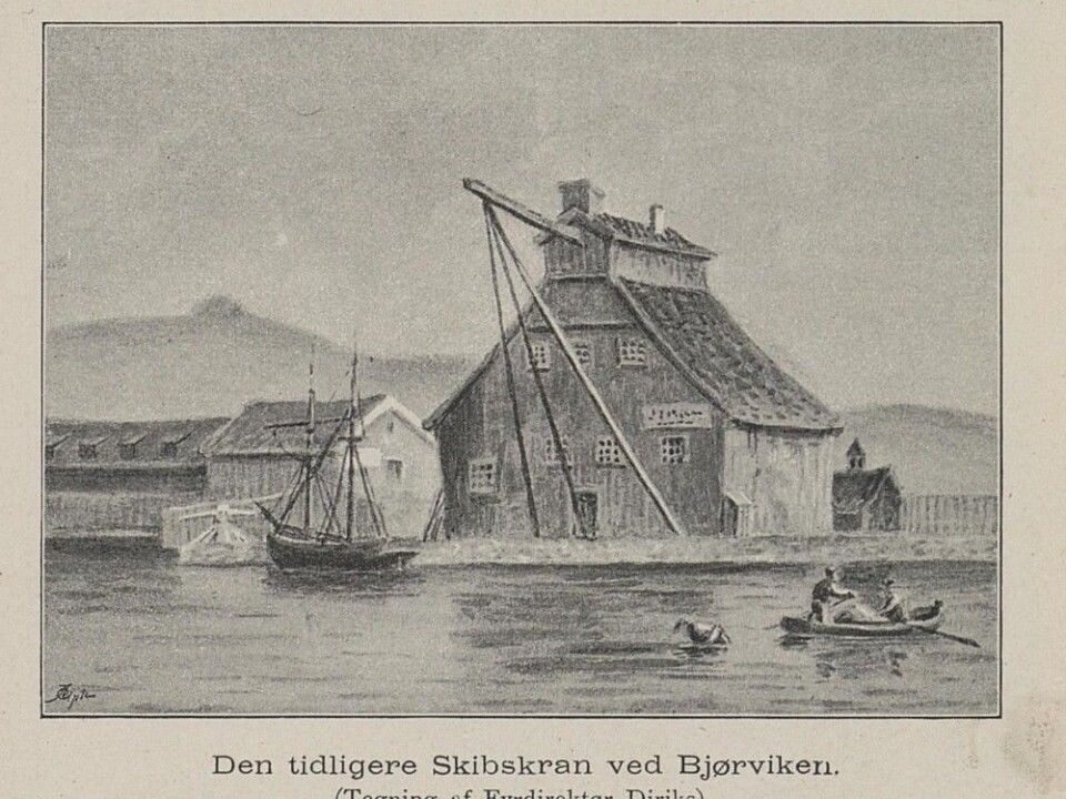
Oslo went through an economic boom in the late 1700s, and new buildings were constructed in the same area where the Barcode Project financial district, near the Oslo Opera House, and Aker Brygge, home of the Nobel Peace Center, are today. Timber trading abroad created wealth in Norway, and the Port of Oslo became an important trading area.
"This was a special time in Norwegian history, and the port is where the market economy in Norway really grew," she said.
Annonse
Hutchinson’s project launched earlier this month, with a test version showing the Port of Oslo in 1798. The website includes a map of Oslo from the 1700s overlain on a modern Google map of the city.
You can click on different areas to see more information about various historical buildings in Oslo, of which most are gone now. And you can also move around with your computer or on your mobile phone, to get a feel of what it was like to be there.
“It's designed to be very simple, you don’t need to download anything. Just open your mobile phone and open the map,” Hutchison said.
Fire insurance assessments
"This project is really just the tip of the iceberg,” she said. “There’s a lot of archival work and research behind this.”
Much of what is known about what the Port of Oslo looked like comes from fire insurance assessments from the period. These are insurance papers that describe entire buildings and interiors in Oslo from the 18th and 19th centuries. And they are very detailed.
"We know who lived in the different buildings, and we can almost say what they ate for lunch,” Hutchison said.
The problem with the fire insurance assessments is that they are written in gothic handwriting, and it takes a long time to interpret what was actually written.
"We have had a small army of people who have been sitting and reading different sources, which we have used for different research projects,” she said.
In addition to the fire assessments, the researchers have used customs archives to figure out what kind of goods were coming to the port as well as ship arrivals for the period around 1800. And the people working in the Port of Oslo were obviously good at recording what happened in the harbour.
"We have very good archive material dating back to the 17th century,” she said.
A wealthy area, then and now
Hutchison is also Managing Director of Tidvis AS, which has developed several different storytelling projects. The Port of Oslo 1798 has been funded by a number of organizations and foundations.
She hopes the project can help people think about Oslo's history and how it has developed over the centuries.
"Around 1800, a whole new financial area was built around the harbour, but now everything is gone. The people who worked there had a lot of money, just like the Barcode Project area today,” she said.
-------------------------------------
Annonse
Read the Norwegian version of this article at forskning.no.


