Annonse
Share your science:
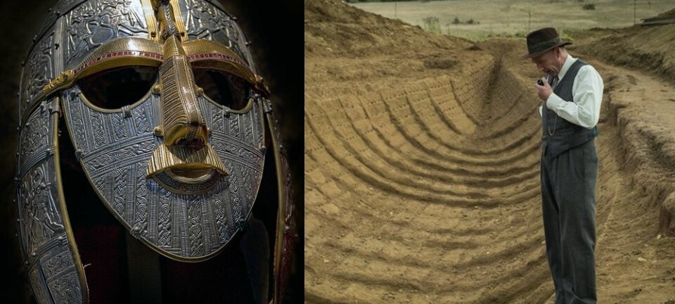
The amazing discovery of a lost Viking settlement
SHARE YOUR SCIENCE: The lost Viking mountain pass that melted out of the Lendbreen ice patch was a fantastic and baffling discovery. The discovery made headlines around the world, but it also raised questions.
Published
Who were the travelers going through this high mountain pass and where were they going? To gain an answer, we realised that we would have to walk in the footsteps of the Vikings – follow the Lendbeen trail and see where it would take us. So we did just that and the trail led us to an unbelievable discovery – a lost Viking settlement!
The lost mountain pass
The lost mountain pass at Lendbreen is the greatest discovery of the Secrets of the Ice program. We found remains of sleds, dead animals, clothing, household items and other eye-popping finds melting out of the ice in the pass. Radiocarbon dates of the finds tell us that travelers used the trail through the pass most intensively around 1000 years ago, during the Viking Age (read more here and here).

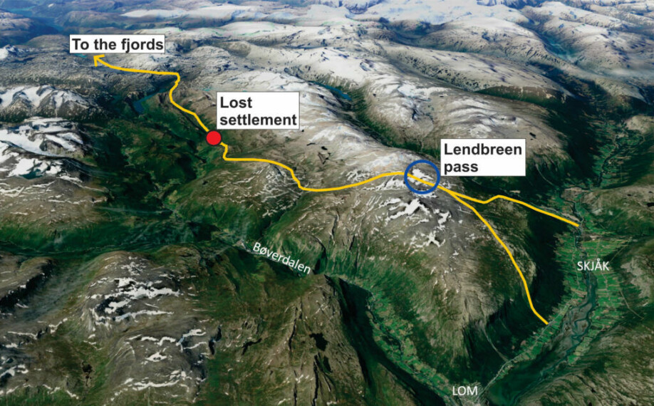
Where did the trail lead from Lendbreen pass?
The discovery of the trail crossing the Lendbreen ice patch was a surprise for us. There were no records of the pass in local history. This immediately raised new questions. Who were the people traveling through the pass and where were they heading? Were they locals traveling to and from their summer farms and pastures, or long-distance travelers going west to the fjords?
Annonse
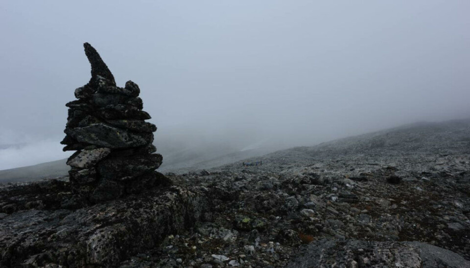
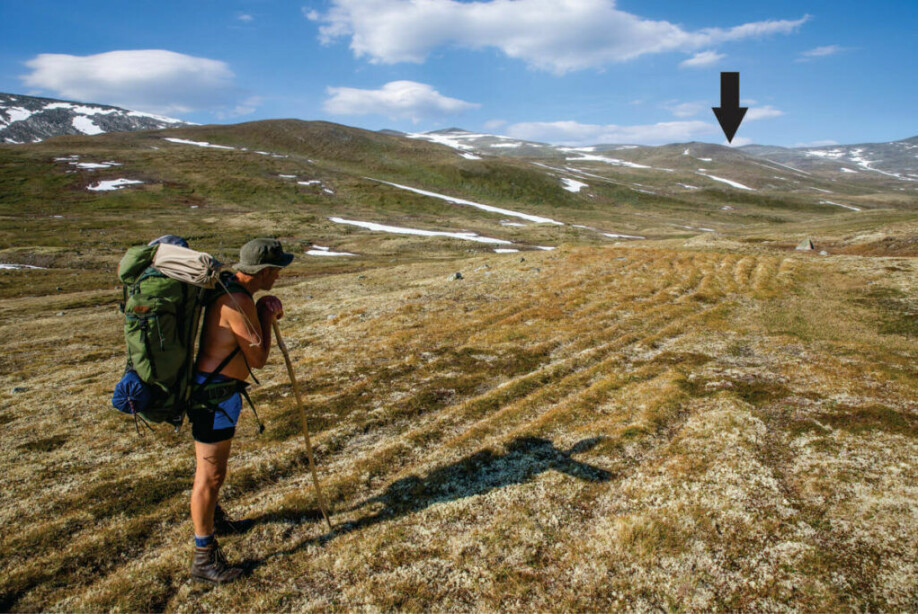
There was only one way to find out: We followed the Lendbreen trail west from the pass to see where it headed. The trail started by going down on the south side of the Lendbreen pass. Cairns and other stone markers clearly marked this section. This was especially the case concerning difficult passages. By following the cairns, we got safely down the steep mountain side even without knowing the route beforehand. We got the feeling that we were walking in the footsteps of earlier travelers without prior knowledge of the trail. The cairns and stone markers helped us in the same way as they helped our fellow Viking travelers a thousand years ago.
We followed the trail into a valley and further west. As we approached the Neto summer farms, the signs of heavy traffic grew increasingly clear. People and their animals had left tell-tale traces – many parallel paths carved into the terrain. Then the trail started to descend towards the Neto summer farms. It became difficult to follow, as juniper covered the area. To our surprise, however, once we got a bit further downhill, the path headed west in the slope above the summer farms. We had expected it to go down to the summer farms. What was going on?
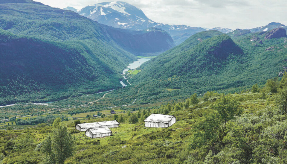
The old Neto legend and the discovery
Intriguingly, there is an old legend about Neto, first noted in the 18th century. The legend claimed that there had been an ancient settlement at Neto, older than the summer farms standing there today. These summer farms only date back to the 17th century. Could the legend be true? Could this ancient settlement in some way be connected to the Lendbreen trail? In that case, where were the house ruins?
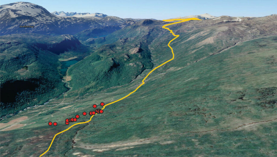
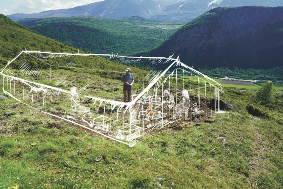
Our local team member, hobby archaeologist Reidar Marstein from Lom, made the break-through. He searched through the dense juniper bushes in the hillside above the Neto summer farms and found a number of potential house ruins, at around 1000 m above sea level. These house ruins lay along the Lendbreen trail over a distance of 500 meters.
Here in Norway, mountain house ruins from the Iron Age, Viking Age and Medieval Period can be difficult to find just using your eyes. The houses were built in wood which has rotted away long ago. Sometimes, all that is left to see are indistinct wall lines, either as rows of overgrown stones or low embankments. With the dense juniper bushes covering the area, it was difficult to be sure if all of Reidar’s discoveries were house ruins.
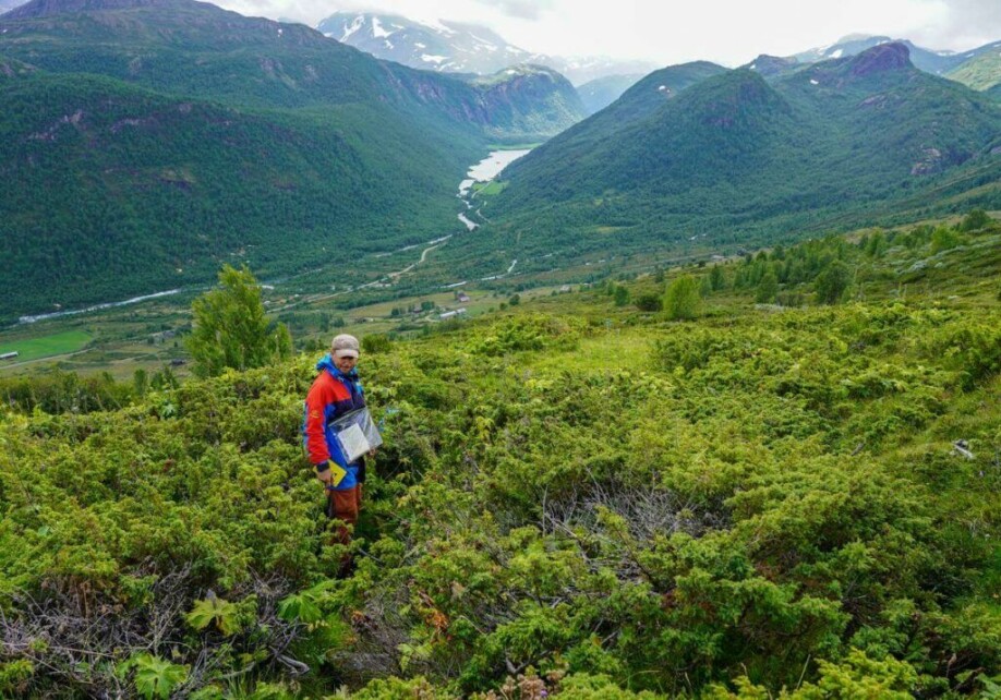
Clearing the juniper
Last summer we started fieldwork in the house ruin area above Neto. We began by surveying the area as well as we could, given the dense juniper. This resulted in a total of 21 possible house ruins.
The next step was to clear four of the house ruins of juniper to gain an impression of their lay-out. The exposed house ruins immediately gave an impression of great age. Their outer walls were visible as low embankments, and small tests with an auger centrally in the ruins revealed charcoal in the ground, perhaps from hearths.
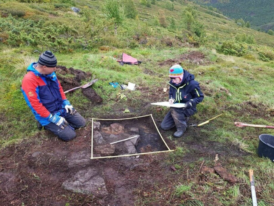
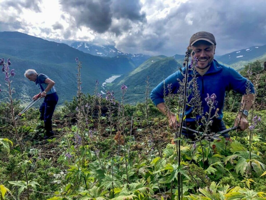
The test excavations
The next step was to undertake small test excavations inside the houses. These test excavations confirmed that the embankments were indeed wall lines from house ruins. The charcoal we found during auger testing was from hearths placed centrally in the houses. We were spot on! There were also remains from stone-built raised platforms along the side walls, which is a typical feature for this type of house ruin. We found no artefacts in our small excavation squares but thick layers of charcoal associated with the hearths made it possible to take samples for radiocarbon dating.
The radiocarbon dates have arrived!
The age of the house remains was still uncertain. From their lay-out and the association with the trail to the Lendbreen pass, it seemed likely that they could be at least medieval and perhaps earlier. We needed to know for sure and submitted five samples from two of the houses for radiocarbon dating. The results are now back and lo-and-behold: All five results fall within the range AD 750-1150 – the period with the most intense traffic through the Lendbreen pass. Surely, this cannot be a coincidence.
New questions
Annonse
The legend was true! There had been an ancient settlement at Neto. We have found the ruins, and we now know that at least two of the ruins date to the Viking Age and Early Medieval period. The other ruins look quite similar, so they may be from the same time or perhaps even older.
However, there are still more questions than answers. We believe that the houses in the Viking settlement are likely connected to the traffic through the Lendbreen pass, since they lie along the path which leads there. They may have provided overnight shelters for travelers. Were they used for other purposes as well? Perhaps our houses were also used for summer farming in the Viking Age? Even all-year farm settlement is a possibility. Pollen analysis from a nearby bog shows that farming starts in the Neto area around AD 300, at the same time as the traffic over Lendbreen began. Surely this is not just another coincidence? The houses could also have been used as a hunting station. Reindeer were hunted intensively in the mountains above Neto.
What’s next?
Espen Finstad, co-director of Secrets of the Ice, is the driving force behind this part of the program:
“The discovery of the Viking settlement is terribly exciting. It adds a completely new dimension to the finds from the Lendbreen mountain pass. But there are still many mysteries to solve here. The plan is to continue the investigations at Neto this summer. We are also preparing further surveys following the trail west from the Viking settlement towards the fjords. We hope there will be more exciting discoveries along the trail here.”
This article was first published on the Secrets of the Ice program site: The Lost Viking Settlement
Share your science or have an opinion in the Researchers' zone
The ScienceNorway Researchers' zone consists of opinions, blogs and popular science pieces written by researchers and scientists from or based in Norway.
Want to contribute? Send us an email!


