SHARE YOUR SCIENCE:

Improving weather forecasts in the Arctic
SHARE YOUR SCIENCE: A fisherman may risk his life, and an ambulance airplane may compromise safety by taking off in bad weather. More accurate weather forecasts in the arctic can save lives.
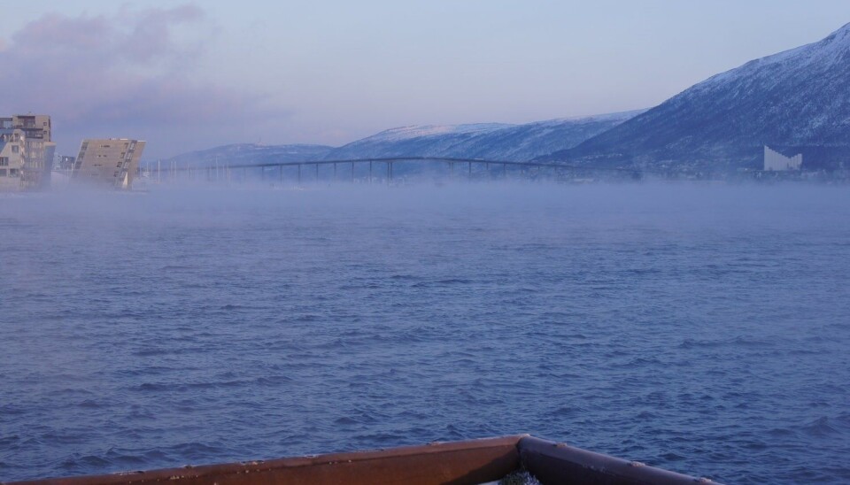
The thick, white fog outside the airport window left no doubt about the reason why my flight from Tromsø to Alta was delayed. It was drifting in from the sea, seeping into every fjord and valley, as is common during late summer and early autumn at these latitudes.
There was nothing I could do other than text message the conference organizer to tell him that I would not be able to come in time for the talk that I had promised to give.
At the mercy of weather
Like everybody else who lives in, or close to the Arctic, my activities depended on the weather.
The distances here are large, and infrastructure is limited. People travel far to get to hospital, school, work, and, in my case, a meeting.
Much of the industry, such as fishery, reindeer-herding and offshore activities are vulnerable to the harsh weather.
During summer it is the sea fog that causes most trouble. During winter there is a range of hostile weather conditions such as strong winds, heavy snow showers, icing, avalanches, and more.
To deal with these conditions, accurate weather forecasts are essential.
A fisherman may risk his life if he goes on sea when bad weather approaches, but he will lose valuable work if an overly pessimistic forecast keeps him on shore longer than necessary.
Equally, the ambulance airplane will not just compromise safety if it takes off in hazardous weather. It may also fail to transport critically ill patients to hospital in time if it stays on ground when it could have departed.
Therefore, a good forecast can make a huge difference, sometimes even a life saving one.

Challenges to meteorologists in the north
Good forecasts, however, are challenging to make in this area. The sparse observation network makes it difficult to monitor the weather situation.
Because of this, forecasters and forecast users depend even more on the numerical weather prediction models for their decisions than their colleagues in the south. But the weather models also need observations to be initialized with correct weather conditions.
Most of the models in use today were developed for lower latitudes, and they struggle to handle many of the polar features correctly.
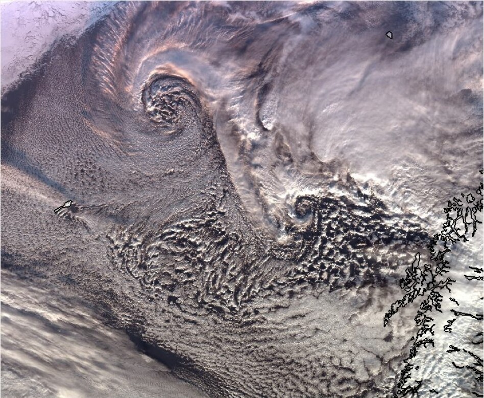
The polar challenges include the marginal ice zone with its mix of ice covered and open ocean areas. There are also the small but intense polar lows that develop very rapidly, strong winds and heavy snow showers, and the frequent shallow and stable boundary layers whose vertical scales are so small that they cannot be resolved properly in the model.
In the end, the lack of observations also makes it difficult to evaluate the issued forecasts and identify the strengths and weaknesses of the model. It was the need to overcome this kind of challenges that made me interested in model development.
State meteorologist gone researcher
As a senior forecaster at MET Norway in Tromsø, I was in contact with users and learned about their needs. I started to work together with the model developers at MET Norway to understand more about how the model that we used works “under the hood”.
I then got the opportunity to work with evaluation of polar low forecasts at the European Center for Medium-Range Weather Forecasts (ECMWF). While there, I used case studies to compare the performance of the ECMWF and Arome Arctic models. My ph.d., which is part of the Alertness research project, will be a continuation of this work.
The aim of the Ph.d. project is to evaluate how good the forecasts were during a number of historical weather events that had a big impact on communities and infrastructure. I will then test the improvements that other researchers do. This way, we can see how much progress we make.

Polar lows and maritime icing
We want to include events from large measurement campaigns with more observations available than usual, such as as for example during the recent Year of Polar Prediction. We will also use particularly interesting cases that forecasters on duty in Tromsø have reported. My own main focus will be on polar low events and maritime icing.
Polar lows can cause sudden changes from clear and calm weather to heavy snow showers and strong, gusty winds that lead to icing, turbulence and avalanches. They are challenging to forecast because of their small scale and rapid development.
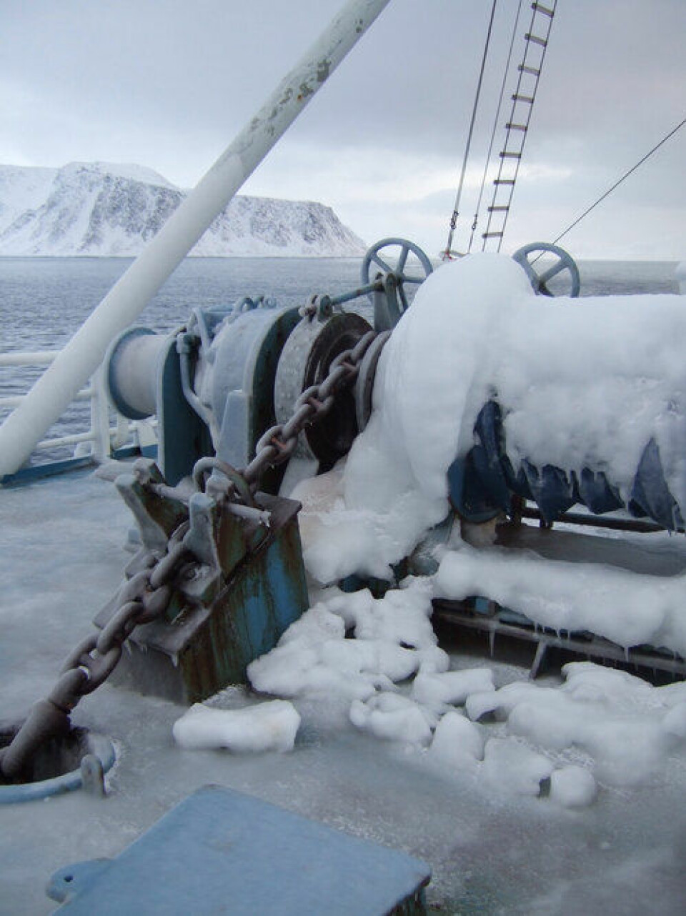
Maritime icing happens when there is a combination of high waves and low air temperature. The sea spray freezes on ships and thick layers of ice build up. This adds a tremendous extra weight to the ship, that can potentially cause it to sink. At the same time, rescue boats and equipment freeze in and become useless.
In addition, I will study cases of fog and aviation icing together with other people in the project. Hopefully, this work will lead to better forecasts to assist those who live in the Arctic and Northern Norway.
If even one life is saved by that, it will be worth every single effort.


