Norwegian instrument on Mars confirms that this is an ancient lake
The researchers see lake sediments under the ground.
The NASA rover Perseverance is exploring a crater on Mars that is almost four billion years old.
The crater was chosen for exploration because everything suggests that there was water there – early in the planet's history.
Now a Norwegian instrument confirms that there are ancient traces of a lake under the wheels of the Mars robot.
The Norwegian ground-penetrating radar RIMFAX can see 20 metres down into the ground on Mars.
Layering in the stone
Researchers from, among others, the University of Oslo present findings from the edge of the ancient river delta in a new study.
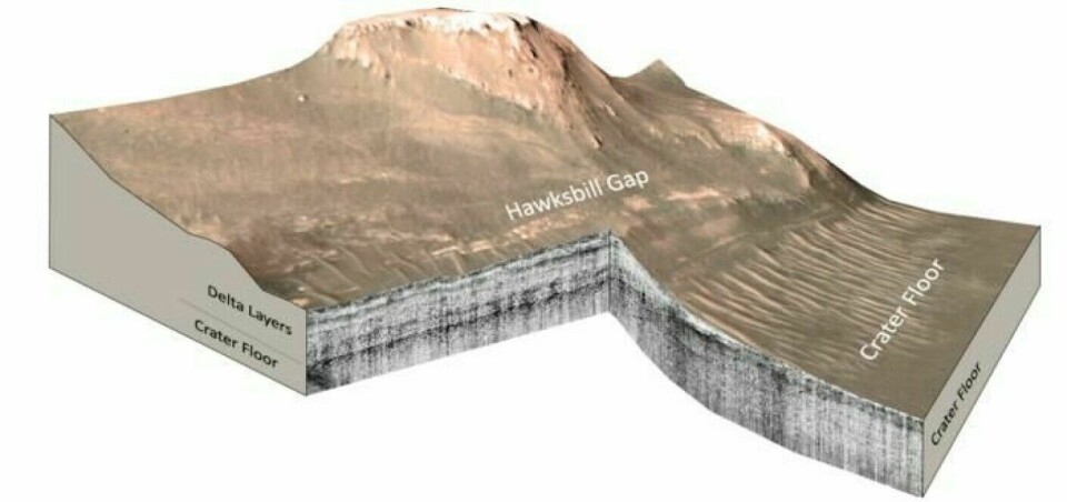
“We see horizontal layers at the bottom of the delta. We interpret this as sedimentary layers that have been deposited in stagnant water, that is, in a lake,” says Svein-Erik Hamran, professor at the University of Oslo.
He has led the development of the ground-penetrating radar and works with the data that RIMFAX collects.
River meets lake
Sediments consist of loose material such as soil, sand, and small grains of rock and sometimes remains of biological material.
The particles are transported by water, wind, and ice and accumulate. Over time, the sediments are pressed together into rocks.
Researchers expected that Perseverance would find rock made of sediments in the ancient crater.
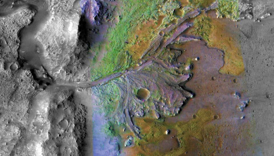
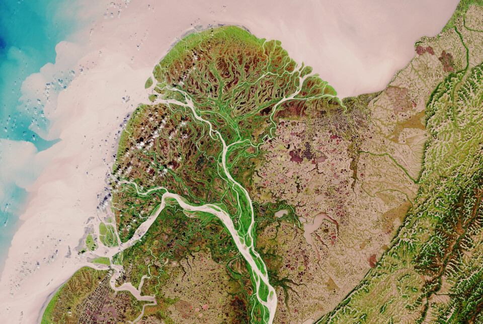
A fan-shaped structure at the end of the crater resembles river deltas on Earth.
Large rivers carry with them stone grains and debris, which are left at the river mouth or out in the lake.
In a river delta, the river has brought material that builds up at the mouth and causes the river to split into several arms.
Found volcanic rock
However, studies from 2022 showed that there were no sediments at the bottom of the Martian crater.
The crater floor is made of volcanic rock. This was shown by data from RIMFAX and the other instruments on the rover.
“It was a bit of a surprise. The geology we found was volcanic,” Hamran says.
These measurements were made near the landing site. Since then, Perseverance has continued its journey.
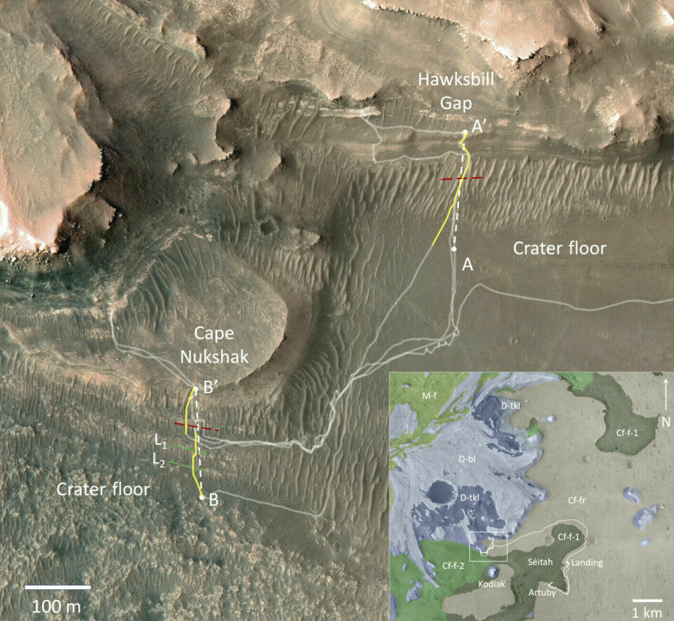
The robot has moved from the flat crater floor and up into the rugged river delta.
The new study deals with the boundary between the crater floor and the ancient river delta.
Here there is a change.
See a transition
“We see a very clear transition between the volcanic crater floor and the delta,” Hamran says.
At the bottom of the delta, there are horizontal layers of rock under the ground. The stone is made of sediments that have settled in still water. In other words, the researchers saw the bottom of an old lake.

Further up in the delta, the researchers see inclined layers, large stones, and coarser material.
“This indicates that there was more energy in the water, and that these sediments were deposited in a river,” Hamran says.
Worn away
If there was a lake and a river in the crater, why are the rocks in the crater floor volcanic?
The research so far points towards there having been volcanic activity in the crater. After that, there was water there.
“We are now quite sure that the volcanic crater floor is older than the delta,” Hamran says.
It is likely that there were also lake sediments at the bottom of the crater, but these have been worn away over time through erosion.
Every year, the wind has eroded away a bit of the sedimentary rocks.
“Over a few billion years, that becomes a few metres,” Hamran says.
“There seems to have been quite a lot of erosion in the area. We see from the radar measurements that there has also been erosion under the crater before the delta came.”
Was larger before
On the otherwise quite flat crater floor, some formations protrude from the ground.
Researchers believe these are remnants of the river delta that have not been worn away. This includes a hill named Kodiak.
“It’s believed that the actual delta extended further into the crater, and then it eroded back. That means that part of the delta has been eroded away and removed. What we see now is what remains,” Hamran says.
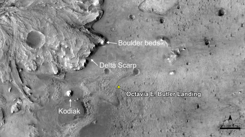
Organic material may have accumulated there
The new study provides hope of finding traces of life in the ancient rock, if life ever existed on Mars.
Perseverance is collecting samples that will later be sent to Earth for analysis.
“Before we landed in the crater, we had observations from satellites. It’s turned out to be quite difficult to interpret the geology based solely on satellites,” Hamran says.
“But now, after we have landed on the ground and conducted radar measurements, we see that it’s true that this is an ancient delta and that there was water there.”
On Earth, the process where rivers collect organic matter from plants and animals and deposit it at the bottom of lakes, is well documented.
“That’s why there was an interest in going to these specific layers at the bottom of the Mars delta. It’s believed that there may be concentrated organic material there,” Hamran says. “The fact that we have now confirmed that, in all probability, there was standing water there, increases the interest in the possibility that there may have been life there.”
Was the water covered by a glacier?
However, it is not entirely certain that there was open water in the crater.
“Some believe that the water was covered by a glacier, and what we see is a process of what happened under the glacier,” Hamran says.
Beneath the glacier, flowing water could have carried material with it, creating the delta underneath the ice.
“This remains an unresolved question,” he says.
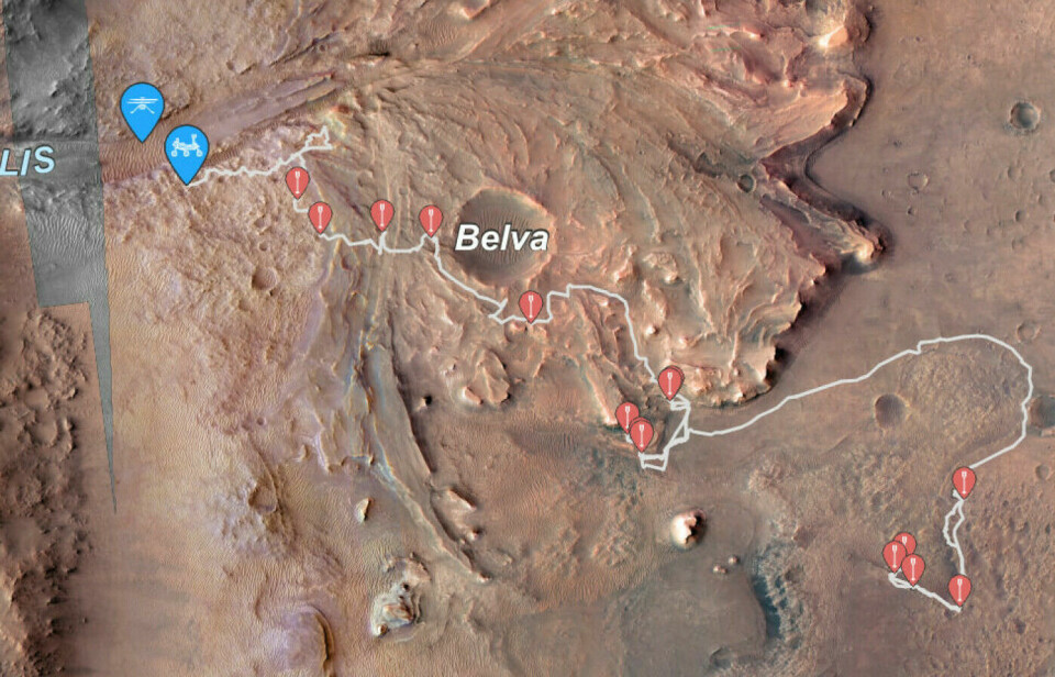
The rover has moved on
While the new study was being written, Perseverance has driven far up into the delta. See where the rover is now on the map above.
“We see very exciting results from where we are now. We are now at a new formation that we don't quite understand what is,” Hamran says.
He explains that it could be a pyroclastic flow, which is a stream of hot gas, ash, and volcanic material from a volcanic eruption.
It might also be that the formation is sedimentary. Future studies will likely tell us more about the history of the crater and the lake.
———
Translated by Alette Bjordal Gjellesvik
Read the Norwegian version of this article on forskning.no
Reference:
Paige et al. Ground penetrating radar observations of the contact between the western delta and the crater floor of Jezero crater, Mars, Science Advances, 2024.


