

Annonse
Results from a Norwegian instrument on the Mars rover provide new hints about water
“It was a bit of a surprise,” says Professor Svein-Erik Hamran.
Published
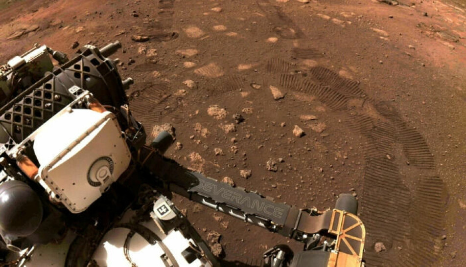
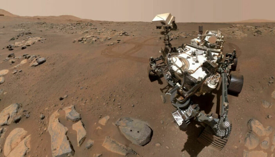
The newest Mars rover, Perseverance, arrived on Mars in February 2021.
Some of the first scientific articles based on data from the robot's instruments have now been published.
Four articles have been published in the journals Science and Science Advances and concern the geology at the bottom of the Jezero crater.
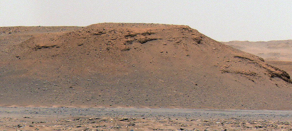
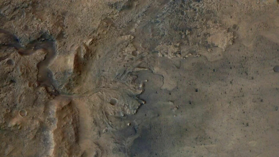
The Jezero crater was selected as the rover’s landing site because scientists believe it housed a lake early in Mars' history. A river delta at the end of the crater shows that large quantities of water must have flowed in.
“These kinds of environments on Earth are places where life thrives,” Amy Williams, assistant professor of geology at the University of Florida, says in a press release.
Annonse
“The goal of exploring the Jezero delta and crater is to look in these once-habitable environments for rocks that might contain evidence of ancient life,” Williams says. She has taken part in one of the new studies.
No seabed
Researchers expected to find old seabed in the crater, specifically sedimentary rocks. These form when layer upon layer of material are consolidated through the agency or action of water.
“We thought we would land on sediments from the lake, but that’s not what was there. It was a bit of a surprise,” Svein-Erik Hamran tells sciencenorway.no.
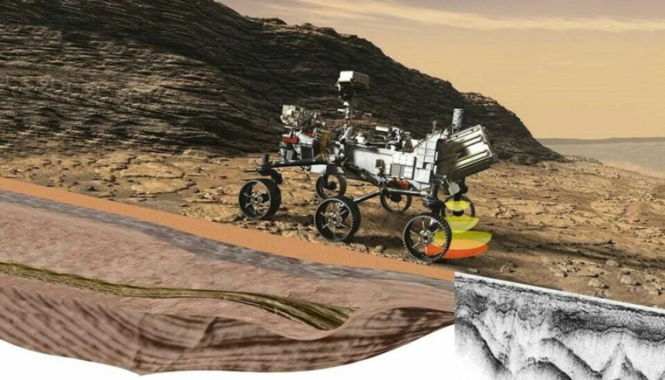
He is a professor at the Department of Technology Systems at the University of Oslo. Hamran has led the work to develop one of Perseverance's instruments: a ground-penetrating radar called Rimfax that can 'peer' several metres into the ground on Mars.
Hamran is involved in two of the new studies – one of them presents the first results from Rimfax.
When scientists talk about sediments, they mean loose masses of rock, soil, or animal and plant remains. Sediments are created when mountains and rocks weather and erode, either by water, ice or just air. Sedimentary rocks are created when these loose masses are pressed together again to form rock.

Subsurface layers
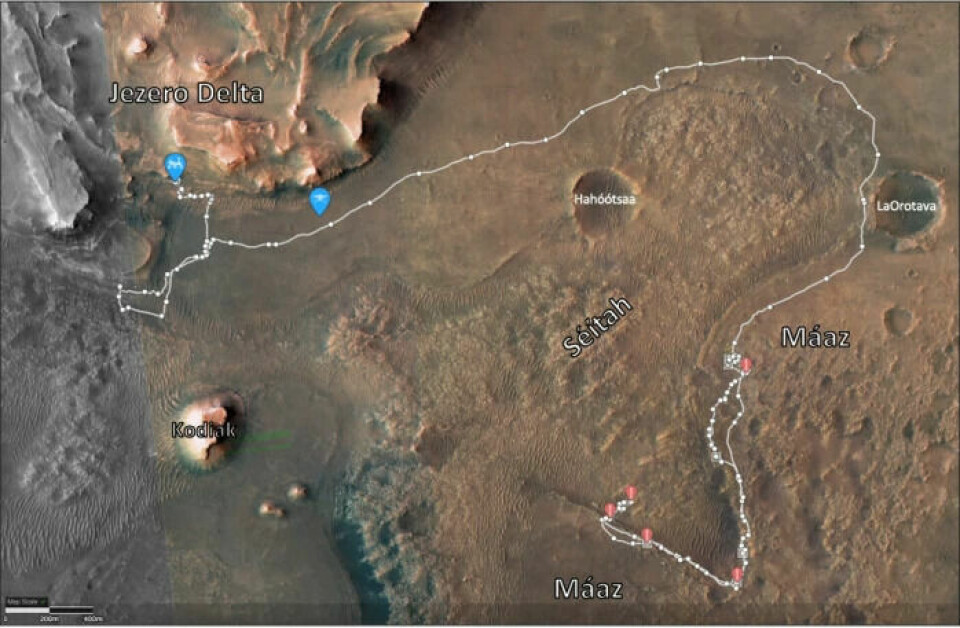
The research on the Rimfax results is based on the first three kilometres Perseverance drove on Mars. This information was collected last summer.
Perseverance drove along a formation called Séitah and ‘peered’ about 15 metres under the surface.
Rimfax revealed a layering in the bedrock beneath the Perseverance's wheels.
“It is very similar to sedimentary structures that we see here on Earth,” says Hamran.
But data from other instruments show that the ground is of volcanic origin. In some places, there are layers in the stone right up to the surface.
“The other instruments have looked at these layers and concluded that they are most likely volcanic, so created from lava flows,” he says.
Annonse
Hamran adds that it is difficult to determine whether a rock on Mars is sedimentary or volcanic.
“The problem is that the sedimentary rocks on Mars are formed from the volcanic ones. Everything on Mars is volcanic. So if you only look at the mineralogy, at what the rock is made of, it is very difficult to say whether it is lava flows or whether it has been converted into sediment in water,” he says.
Slopes 15 degrees
Another discovery in the Rimfax data does not quite fit with the theory that the crater floor consists of sediments.
“Seabed sediments are often horizontal. Especially in a small lake in a crater on Mars, one would think they were horizontal,” says Hamran.
But this was not the case along the Séitah formation.
“What we discovered through Rimfax was a layering in the rock that sloped downwards 15 degrees away from the Séitah formation,” he says.
Slow cooling rate
The researchers believe that the sloping is due to the fact that the layers in the bedrock have first been formed horizontally. Subsequently, there has been a local volcanic intrusion underneath which has lifted the layers up and created inclines.
As for the layering in the volcanic rocks, the researchers believe that it originates from molten mass that has solidified late.
“If the lava cools down very slowly, you get deposits of different minerals at different temperatures. Those that solidify at a new temperature fall down. Temperature changes that are slow will then produce layered rocks. In geology this is called a cumulate,” says Hamran.
An alternative interpretation is that the sloping layers at the Séitah formation originate from an older delta – a different and older delta than what is visible on the surface.
“When sediments build up in a delta, you get layers such as these that are left sloping outwards,” Hamran says.
If that is true, there have been several periods of a lot of water in the crater.
- RELATED: Study finds signs of ancient megafloods on Mars – pure speculation, says professor in Norway
Has been water
The Jezero crater was formed by a large meteorite impact. In reality, the crater should be much deeper, and therefore researchers believe it has been filled with either sedimentary or volcanic rocks.
“It seems that it has been filled up with either a lava flow that came up from below the crater, or that lava has entered into the crater over the edge,” Hamran says.
What does it mean that the researchers did not find sedimentary rocks at the bottom? Wasn't there a lake in the crater after all?
“Yes, there has been water there,” answers Hamran.
“But there has probably not been stagnant water there for as long as one might have first thought. You can see that stone has been transformed by water. It is a bit strange that there is not more sediment in the crater,” he says.
It may be that there were sediments, but that they have been eroded away.
Perseverance is now in the delta itself at the end of the crater. Here it is quite obvious that the delta has clearly been shaped by water, Hamran explains.
Magma lake?
One of the new studies summarises what the early investigations say about the crater floor.
There are two ways to explain the volcanic rock, according to David Shuster, a geochemist and professor at the University of California, Berkeley.
“Either the rock cooled underground and came up from below, somehow, or there was something like a magma lake that filled up the crater and cooled gradually," Shuster says in a press release.
More to come
This study is only the first to come from Rimfax. Perseverance has now driven another nine kilometres since last summer.
“We are now in the delta. Here we see structures in the ground which are very interesting and which will appear in new research articles,” Hamran says. He is involved in operating Rimfax and is satisfied with the results.
“The instrument has worked from day one and we have had good results throughout,” he says.
Perseverance is in the process of collecting rock samples to be retrieved and transported to Earth in a few years.
“It is very important to know the geology, how the rock samples brought back to Earth were formed. Rimfax is important in this larger context,” Svein-Erik Hamran concludes.
———
Translated by Alette Bjordal Gjellesvik.
Read the Norwegian version of this article on forskning.no
References:
Hamran et al. Ground penetrating radar observations of subsurface structures in the floor of Jezero crater, Mars, Science Advances, August 2022. DOI: 10.1126/sciadv.abp8564
Farley et al. Aqueously altered igneous rocks sampled on the floor of Jezero crater, Mars, Science, August 2022. DOI: 10.1126/science.abo2196
------


