
Annonse
Norway's largest ‘fjord’ is only a few hundred thousand years old
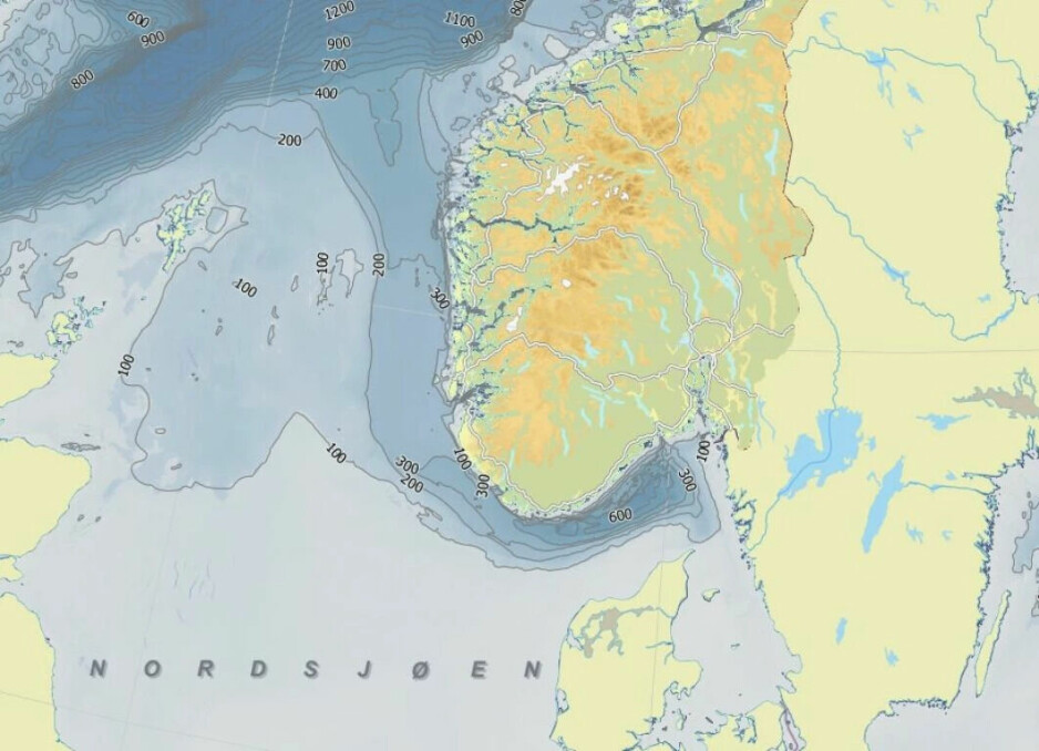
The Norwegian trench is a giant underwater ‘fjord’ formed by an enormous glacier.
Published
In a new study, researchers have concluded that the 700-metre-deep Norwegian trench is quite young.
You see, for geologists, 350,000 years is anything but old.
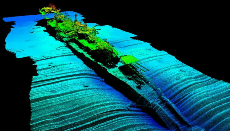
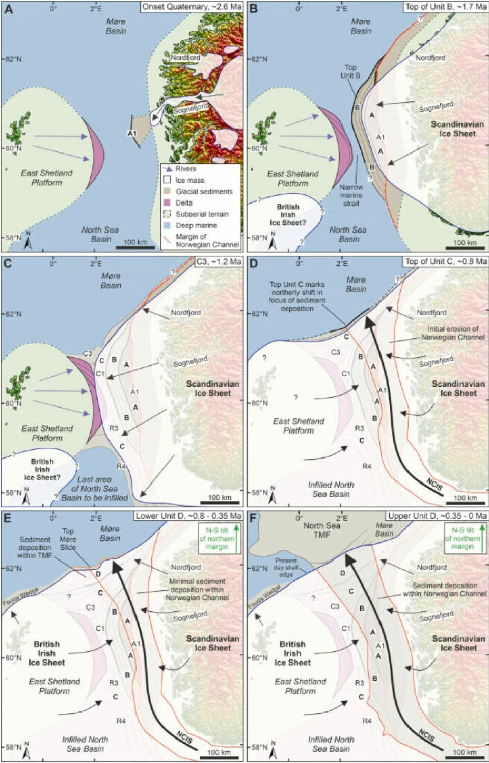
In the study published in Marine and Petroleum Geology, researchers at Equinor and the University of Newcastle have examined the traces of ice that formed the huge trench around the entire coast of southern Norway.
Created during the penultimate ice age
The Norwegian trench was formed by a smaller glacier that protruded from the much larger Skagerakk glacier.
Annonse
The glacier was a giant ice cap that covered much of Sweden, the Baltic Sea and Norway.
This took place two ice ages back, so not during the very last ice age.
The penultimate ice age may have lasted from about 400,000 years ago until about 130,000 years ago.
It may have been during this ice age that much of the Norwegian trench was created.
Deepest outside Arendal
The huge glacier was an extension of Skagerakk glacier outside Bohuslän in Sweden. It had collected enormous amounts of ice and thus gained a lot of power.
Norwegian fjords formed by glaciers during the ice ages are often deepest a good distance inland. Further out to sea, they become shallower and often have a threshold. Fjord thresholds are shallow regions near the mouth of the fjord.
Like these other Norwegian fjords, the Norwegian trench is deeper where it first started forming. It is at its deepest outside the town Arendal.
Clearly younger than expected
In the new study, researchers have concluded that sediments (rock, gravel, sand and clay) in the Norwegian trench are significantly younger than previously thought.
“Using a large 3D seismic data set, we have mapped ice movements throughout the ice age,” lead author Helge Løseth tells geoforskning.no (link in Norwegian).
“In short, we could not get previous dates to fit,” he says.
These were dates that pointed in the direction that the Norwegian trench must have been formed more than 1.1 million years ago.
Now the researchers have instead come to the conclusion that sediments at the bottom of the Norwegian trench are only 350,000 years old. In other words, significantly younger than the previously assumed age of the underwater ‘fjord’.
Annonse
A strong ice stream north
“In our article, we show that the ice age started with ice covering our country. Fjords were created and the ice moved beyond the continental shelf,” Løseth tells geoforskning.no.
When the ice sheet that spread out from Norway met another large ice sheet creeping in from Shetland which eventually also covered Great Britain and Ireland, the ice masses had to find a new direction to move in.
They started moving north.
The bottom of the North Sea tells the story of the ice age
Helge Løseth and colleagues have also previously used the 3D images that have come from the seabed in the North Sea in recent years to uncover completely new knowledge about what happened during the ice ages.
There are almost no traces of any ice ages on land in Norway except the very largest: valleys and fjords.
The only traces we find on land are after the very last ice age.
In clear contrast to this, the new 3D images from the seabed in the North Sea can give geologists insight into developments during much of the last ice age period. Here we are talking about all the last 30-40 ice ages during the last period of ice ages on earth.
The North Sea is now probably the best-mapped seabed in the world and is what makes this research possible.

A giant ice sheet
In a previous study, Løseth and his colleagues found traces of what happened when the very first ice settled over Norway 2.6 million years ago.
From the ice sheet that formed, giant glaciers began to move, similar to the glaciers found in Greenland and Svalbard today.
“The very first glacier probably came from where the Sognefjord meets the sea,” Helge Løseth told forskning.no a year and a half ago.
Eventually, glaciers formed in Nordfjorden, Sunnfjord (Førdefjorden) and Hardangerfjorden. The ice that spilled from the mainland gradually spread beyond the Norwegian continental shelf.
Using the new 3D images from the bottom of the North Sea, scientists can now identify layers upon layers of sediments from the ice ages. Right from the beginning, 2.6 million years ago, until today's seabed was formed.
———
Translated by Alette Bjordal Gjellesvik.
Read the Norwegian version of this article on forskning.no
Reference:
Løseth et al. A regionally consistent 3D seismic-stratigraphic framework and age model for the Quaternary sediments of the northern North Sea, Marine and Petroleum Geology, vol. 142, 2022. DOI: 10.1016/j.marpetgeo.2022.105766