Annonse
The truth is in the sediments
OPINION: The seafloor has different patterns on top than underneath the surface. Researchers at Nord University suggest that new seafloor research in the Lofoten-Vesterålen region contributes to future marine management.
With the growing human population and the ongoing economic development, one of today’s greatest challenges is the sustainable use of natural resources, especially in the marine environment.
The practical way to organize the use of the marine space is marine spatial planning in the attempt to balance the need to protect marine ecosystems with social and economic needs. Spatial planning defines spatial units of ecosystem functioning and takes measures to ensure that the ecosystem functioning is preserved for the future.
Ecosystem functions are strongly related to an ecological community, which is a group of organisms that are interacting in a habitat. Its structure, composition and distribution are determined by environmental factors, like temperature, light availability or the local substrate. Accordingly, effective marine spatial planning is relying heavily on knowledge about the spatial extent of communities.
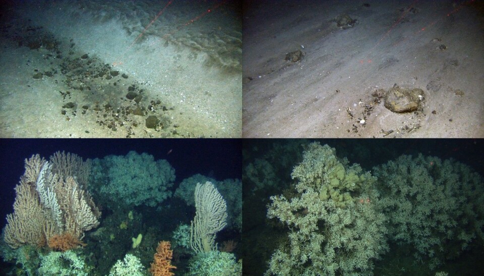
Such spatial units are rather easily defined on land, where humans have direct access and can observe the ecosystems from within. For marine ecosystems and especially for deep seafloor habitats, such spatial scales are very difficult to assess, since scientists rely on scattered video surveys or even more scattered biological sampling to describe vast areas.

Due to the high costs of biological sample processing, spatial extents of benthic communities, are primarily defined by marine scientists, through video analysis assuming that the complete communities follow the same spatial patterns that can be observed in this way.
Annonse
In a recently published study in Ecological Monographs, we and our partners from the Norwegian ARCTOS LoVe MarinEco project and the MAREANO program show that spatial patterns of seafloor community components display varying patterns at different spatial scales, depending on whether they live within or on top of the seafloor.
To do so, we combined our collected data with an extensive seafloor community data set provided by the MAREANO program.
In our study, we show that in the case of the sub-Arctic Lofoten-Vesterålen region, the main spatial units separate the complete seafloor ecosystem in two communities, one associated with warmer water masses shallower than 800 m depth and one associated with cold water below 800 m depth.
However, covered by this dominant spatial pattern, the study shows that differences occurred in the spatial patterns of above ground and below ground communities. Sediment characteristics play an important role for the below ground community, while the above ground component was not much affected by this environmental factor.
Clearly, this study shows that environmental management should not consider benthic communities as a single unit that follows a common spatial pattern, which is driven by the same environmental factors. Spatial management of marine resources rather needs to account for the multi-scale nature of these ecologically important communities.
Reference:
Silberberger MJ, Renaud PE, Buhl-Mortensen L, Ellingsen IH, Reiss H: Spatial patterns in sub-Arctic benthos: multiscale analysis reveals structural differences between community components. Ecological Monographs, doi:10.1002/ecm.1325


