How the last ice age changed Norway
Researchers are learning more about what happened when several thousand metres of ice covered Norway roughly 10 000 years ago.
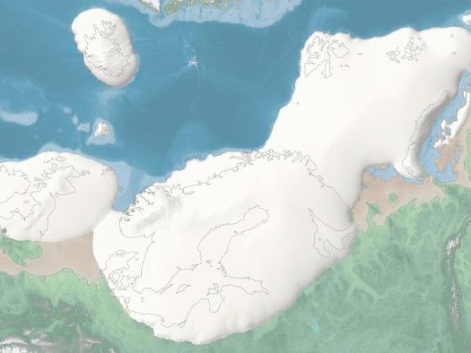
Researchers at the University of Tromsø —the Arctic University of Norway have made an interactive map that shows how the ice cap that used to cover northern Europe has changed throughout the last ice age. It was at its thickest about 20 000 years ago.
The researchers, from the university’s Centre for Arctic Gas Hydrate, Environment and Climate (CAGE) centre have also created an entire website “for children of all ages” to explain the newest findings about this dramatic part of the Earth’s history.
Learn more about the last Ice Age in northern Europe and explore the interactive map below.

Explore the interactive map above or click here to view fullscreen in a new tab.
The big melt 10 000 years ago
“The last ice age is a fascinating story of natural climate change,” says Maja Sojtaric in an article on geoforskning.no. She is head of the CAGE centre at the university.
The Earth’s northern hemisphere is thought to have been through as many as 30 ice ages during the last 3 million years, with the latest ice age lasting about 100 000 years. Each of these ice ages was broken up by about 10 000 years of warmer weather.
The Earth is currently in one of these inter-ice age periods.
The researchers in Tromsø are working to convey the extent of the impact that the enormous ice cap had on the environment and people as it melted 10 000 years ago.
Follow the ice age and its changes on a map
The CAGE researchers have learned a lot about the variations in the extent of the ice over northern Europe, and how it affected both the land and ocean.
Norway’s rugged coastline with its steep sided fjords was strongly influenced by the ice age, as were inland rivers and valleys. The ice also created large inland lakes.
The Science Centre of Northern Norway in Tromsø is also currently featuring an exhibit on the last ice age.
-------------------------------------
Read the Norwegian version of this article at forskning.no.


