Annonse
Share your science:
Using drones to accurately map life under water
SHARE YOUR SCIENCE: Gone might be the days when scientists had to manually count species and describe types of nature. And with better knowledge from drones will come better protection.
Published
How do you accurately map under water vegetation and shallow water marine life along the second largest coastline in the world (The Norwegian one that is, in case that wasn’t clear)? Maybe more importantly, why would you want to?
I am an undergraduate student of Marine Biology at the University of Plymouth, England. I spent the fall of 2019 in Oslo working with the Norwegian Institute for Water Research (NIVA) trying my best to answer these questions.
The answer to the first one is drones. Drones are the future for mapping and monitoring our natural resources.
The answer to the second question is that we need to know what life is out there, in order to make sure we preserve rather than damage it for future generations. Better knowledge will give better protection.
Annonse
The quality of underwater nature
So-called shallow water coastal zones support a high diversity of important underwater habitats – meaning types of underwater nature, that are important for fish, birds, crustaceans, invertebrates, plants and microbes to flourish.
These coastal zones include some of the most diverse marine habitats on the planet, such as shallow vegetated habitats, reefs, kelp forests, soft and hard bottoms and open waters to name just a few.
The importance of these different nature types has long been acknowledged as invaluable for fish and invertebrates; specifically, in the role they play in the early life stages of many species.
They also play a fundamental role for water quality and impact the movement and abundance of invasive species and marine litter.
We know that many species rely on these shallow water habitats in order to fulfil parts of their life cycle.
Their survival, growth and reproduction rates are all influenced by the quality of underwater nature.
Below the clouds and under the water
Traditional field sampling and monitoring methods, such as hand counting the number of organisms in an area, can be time consuming and arduous work when sampling large areas.
However, the potentials of so-called remote sensing can revolutionise field sampling techniques.
Remote sensing means using normal or specialised cameras to collect images of radiation – typically this will be done from a satellite or an airplane. These techniques allow us to get images of large areas of the Earth’s surface. They can help with tracking the weather, natural disasters, changes in the growth of cities or forests over years, and so on.
Unfortunately, satellite remote sensing efforts have so far been only partly successful. The resolution of the images from satellites are too low, and the images can be disturbed by for instance clouds.
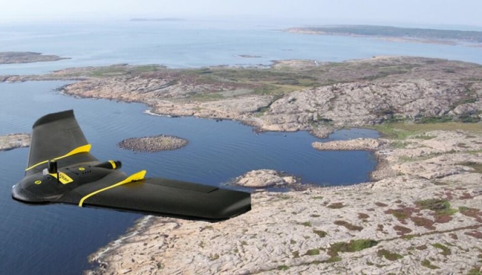
Enter: the small flying drones.
When equipped with sophisticated optical sensors, these drones are able to support high resolution images. And they fly below the clouds.
Annonse
The technology is still in its infancy, but the potential applications are multiple.
One million times more data than scientific satellites
A team based at NIVA have been working with drones on various projects since 2016. They are certain that drones are the future for mapping and monitoring our natural resources.
Part of the reason for this is the quality of the images obtained from drones; flying at 100 metres above the ground, the attached cameras are able to capture images with a resolution of 3cm x 3cm. This gives us almost 1,000 times better image quality - or one million times more data points than even scientific satellite imagery can provide.
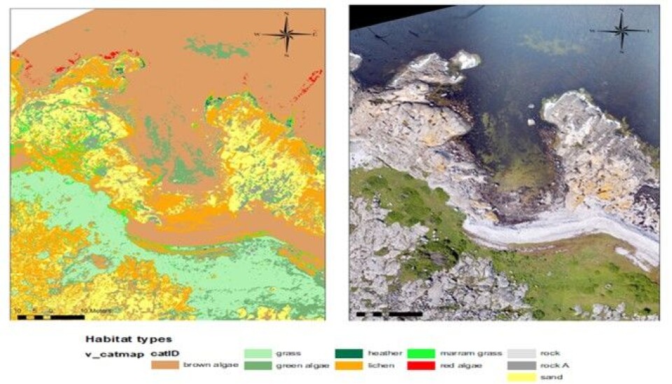
The different images have been used to help the researchers at NIVA to identify and map different types of underwater vegetation like brown, green and red algae, as well as non-vegetated areas like sand and rock.
Knowing where these habitat types are, and how much of them there are will give us some insight into the overall health and quality of the environment.
Five days of flying drones
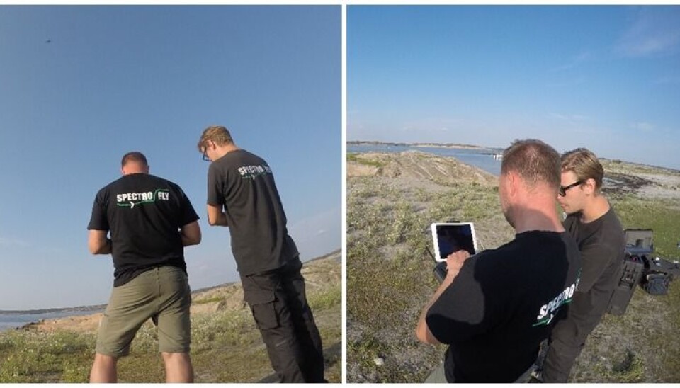
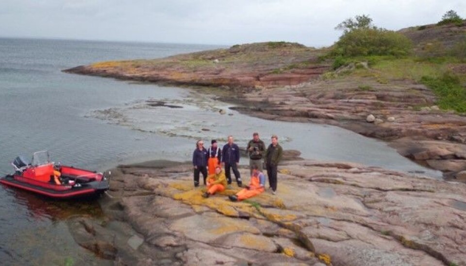
And so, at the end of August last year, I spent five days along this long Norwegian coastline, flying drones.
This field work was part of the Frisk Oslofjord project, an ongoing project looking into the ecological conditions and the health of the Oslofjord following recent declines in important habitats and fish stocks.
Our team from NIVA teamed up with Spectrofly – a drone imaging company from Denmark - to map out the shallow waters of the Oslofjord. We captured images from both Ytre Hvaler and Færder national parks, in the Southern Oslofjord of Norway.
Over the five-day period of field work, almost twenty drone flights were performed. A total of 46,504 images were taken, and 29,321 of these images were stitched together to create one single image mosaic for each flight.
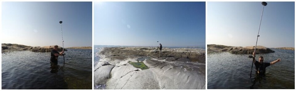
We also collected ground truth data – that is data that we manually collected on the ground.
This would involve me or others wading into the water in order to get the GPS position of a particular type of underwater nature, like the exact position of a sandy area, or a patch of brown algae. This ensures that we are training the computer to recognise the right nature type patterns, so that it will get better at identifying the correct nature types.
Better knowledge will give better protection
Back in the office, the team started analysing the images. Every type of nature has an individual colour pattern caused by the specific reflectance of different wavelengths of light; like an optical fingerprint. Once the software recognized these wavelengths, it could classify habitats, and present them in images.
The work we are doing here only scratches the surface of the multitude of potential uses of these new drone technologies.
Further development of applications and their potential to modernise coastal remote sensing is in the making. A new national infrastructure named SeaBee (www.seabee.no) funded by the Norwegian Research Council has also been established.
The next steps include creating even more detailed images, which more accurately determine habitat types.
SeaBee plans to use similar techniques as we used for our NIVA-project, to create a large scale automated coastal monitoring system, with the aim of quantifying mammals, seabirds, marine debris and water quality. This information should give us some insight into the health of Norway’s coast on a national level over time, giving us a better understanding of where protective management actions are needed.
Share your science or have an opinion in the Researchers' zone
The ScienceNorway Researchers' zone consists of opinions, blogs and popular science pieces written by researchers and scientists from or based in Norway.
Want to contribute? Send us an email!