Annonse
Share your science:
Arctic sea ice retreat is well observed by satellites and new technology. So why do we still need scientists working on the ice?
SHARE YOUR SCIENCE: Sea ice is an essential part of Earth’s climate and ocean systems, and in the Arctic the ice decreases year by year.


Published
Collecting data is important for understanding this reduction which leads to a northward retreat of the ice edge. This opens up for more ship traffic, oil and gas exploration, fisheries and tourism in these regions, which were not accessible before.
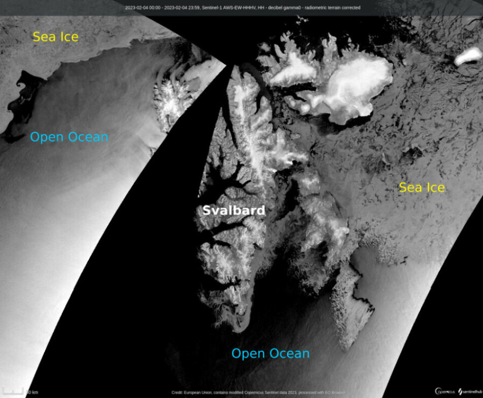
Since warming in the Arctic is faster than our climate models have predicted so far, we know that there are still climate processes that need further investigation. Sea ice scientists often look at satellite data, which has given us a great overview of the polar regions for the last half a century, but these images only give us the big picture.
To fully understand the sea ice and the polar ecosystems that rely on it, we need scientists carrying out field experiments above, on and below the ice. By understanding the small-scale processes only observable in the field, we can fill in the gaps in our knowledge of one of Earth’s most fragile environments.
Satellite imagery helps us to see the big picture
The last 50 years of satellite imagery have provided a wealth of information for scientists observing the polar regions. Having good quality and regular satellite data is important not only for the biologists, chemists and physicists, but also for forecasting and warning services that rely on imagery to help ships navigate through the ice.
Annonse
Satellite images also give us the big picture of ice thickness, concentration and ice motion/ speed. This has been helpful for understanding the large scale changes we are seeing as climate change advances, but the small scale processes are difficult to monitor, leaving us with critical gaps in our data and our ability to see the true picture. So how do we solve this data gap? Field Observations!
Field observations give scientists the opportunity to investigate processes in the atmosphere above, within and below the sea ice. These observations we call ‘ground truth’, are important because they are used to check the results from the models and satellites.
In some cases, what we observe in the field is very much at odds with what the models are telling us, or what the satellite data indicates. When we integrate these field observations into the models, it helps to improve reliability.
There are a wide range of observing methods
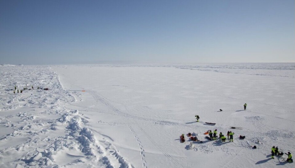
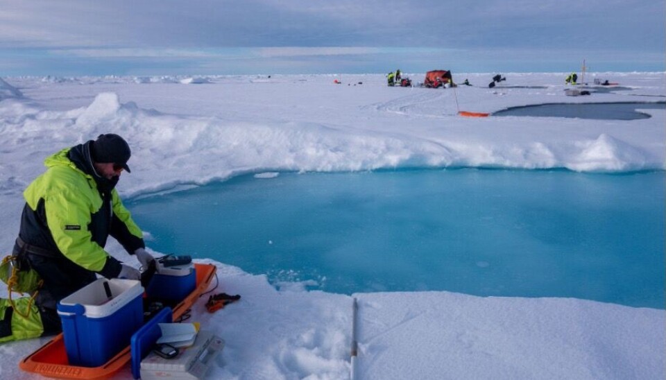
The majority of field observations are carried out by icebreaker expeditions to the ice covered regions. During the expedition, instruments are placed on the ice with sensors to measure temperature, salinity, density and other properties within the ice itself as well as in the ocean below and in the air above. Long term monitoring instruments, which operate autonomously in the ice, are important because they give scientists a stream of data during the following months or even years.
You have probably seen pictures of scientists on the sea ice. Stick figures in a vast expanse of white as far as the eye can see. But with what instruments and methods are these stick figures actually working with in this endless landscape shaped by snow, storms and icy cold. In the next section we give a short insight into some of our ‘on ice’ equipment and the data we receive from it.
We investigate the ice from all directions
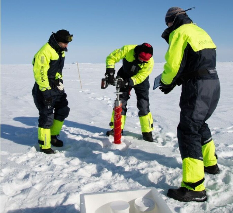
The first and perhaps most well known method for investigating the sea ice is ice coring. A tube with metal cutters is placed on the ice and a person manually drills it down. When the tube is filled with sea ice, it is pulled up and the ice core is taken out. Then the scientists can measure thickness, temperature, saltiness, weight and other properties of the sea ice. The same procedure is repeated for other sites, giving us data on how the sea ice properties vary from one place to another and from year to year.
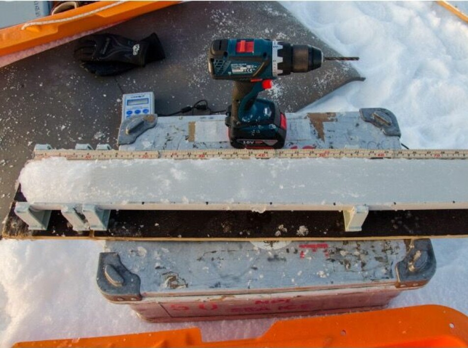
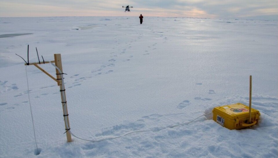
However, there are also other instruments that are used to collect data on sea ice temperature, thickness and drift. The most important are automated ice buoys, instruments that drift with the ice floes while collecting data. The data are then transmitted via satellite to scientists on land. To measure the thickness from the underside, upward-looking sonars are placed below the sea ice on the seafloor with a string of instruments extending into the water. The sonars are instruments that use sound waves to measure the response from the ice above and therefore allow scientists to calculate thickness. Data is collected in a fixed position over a period of one or two years and scientists can retrieve the data after the instruments have been recovered.
New technology is helping us observe the ice like never before
New technologies for data collection are evolving, such as drones flying above the ice and underwater vehicles operating underneath the ice. Both these methods offer high resolution data which we’ve not had access to before. These methods are under development as research tools, and are not yet used in regular data collection. For all the methods used, a scientist needs to be in the field which requires the use of icebreakers that can sail far into the sea ice.
Who are the users of all this sea-ice data and why should we all care?
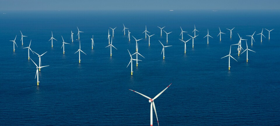
Sea ice services depend on these field observations to improve ice charts and develop sea ice forecasts. Scientists, ship captains and fishermen can use these ice charts to plan safe routes through the ice. Other sectors who need ice information are research, oil, gas and the wind energy sectors.
As the Arctic opens up to increased marine traffic, geopolitical interests and adventure tourism has become more popular. But less ice doesn’t always mean less danger in ice covered waters. With the reduction in sea ice thickness comes a more dynamic ice pack and increased risk of accidents at sea. Not only this, but we are also seeing a shift in marine ecosystems that depend on sea ice.
Annonse
By understanding the ice better, we can look at how changes in extent, thickness and drift will affect wildlife around the high Arctic. Therefore, it is vital that we still have scientists in the field carrying out observations, because satellites really do only give us part of the story.
FURTHER READING:
Share your science or have an opinion in the Researchers' zone
The ScienceNorway Researchers' zone consists of opinions, blogs and popular science pieces written by researchers and scientists from or based in Norway.
Want to contribute? Send us an email!


